Tramps of San Francisco

In search of San Francisco's forgotten histories

The San Francisco Mission Zoo: Wilder Days in Glen Park (Part II)

Part II: Dame Nature Has Done Her Part

“Next to the Klondike excitement, the subject which is creating the greatest local interest is that of a Mission Park.”
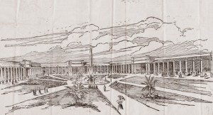
Design for the new Mission Park Zoo in Glen Park’s Gum Tree Tract by prominent San Francisco architect Frank S. Van Trees in 1897. In the “Italian renaissance” style, the zoo would have 38 cages of various sizes for the proposed menagerie. In the San Francisco Daily Report, August 7, 1897. California General Subject Collection. Courtesy of the Alice Phelan Sullivan Library, Society of California Pioneers. (Click image to enlarge)

Those who knew and loved the Gum Tree Grove in the area of today’s Glen Canyon claimed, “Dame Nature Has Done Her Part.” The tract was treasured for “… its fine climate, its diversified topography and its accessibility to all parts of the City.”While the Supervisors ultimately rejected the land purchase and chose instead to use appropriations for the improvement of roads, schools, and utilities, the fondness with which supporters spoke of the Gum Tree Tract provides us with deeper insight as to what the neighborhood of Glen Park used to be like. Concurrently, a grand design for the new zoo by a leading San Francisco architect portrayed what supporters back in the day wished the future for Glen Park would hold.

Members of the Fairmount Improvement Club, adjacent to the proposed grounds, agreed that,

“The gum-tree tract is the place. We want crowds to visit the Mission. A zoo there will bring the people here. Many live near the grove, and can walk there. The streetcars pass it. Those who want to drive there can do so, and after passing through can drive on to the Golden Gate Park and to the Balboa road without having to go three miles out of their way. It is the natural outlet and driveway from the Mission to Golden Gate Park.”

It was also noted that there were,

“… about 100,000 trees of various kinds on the grounds … the entire land is filled with natural springs and running water. This item alone would save the City at least $6000 per annum.”

In their opposition to the suggestion by oppositional Mission residents that the more suitable location was “… in the vicinity of the Jewish Cemetery property, which consists of two blocks of land between Eighteenth and Twentieth, Church and Dolores streets” (today’s Dolores Park), the Fairmount Improvement Club resolved that,

“… a large park and a zoo will bring more people to the Mission and afford more enjoyment to a larger number than a mere square; … the ‘Gum-tree Tract’ is well adapted for the purpose of a park and a zoological garden …”

The Fairmount Improvement Club, among others, also opposed the price of the Jewish Cemetery property, an enormous $300,000 for just 14 acres in 1897, compared to Baldwin and Howell’s 145-acre Gum Tree Tract, offering 131 additional acres for only $87,500 more.

Other residents, such as druggist John H. Dawson (whose business was located at Twenty-second and Valencia and who had been a Mission resident for 20 years) noted that the Mission Park would, “… insure to the City a magnificent zoological collection and be a boon to and a source of pride to the whole City …” and “… would form an attraction that would be reckoned among the resources of the coast.” Patrick Wall, a Mission resident and large land owner “since the early days” pointed out that,

“The northern part of San Francisco is well supplied with parks. Not only is Golden Gate Park available, but the Presidio and Black Point reservations and Sutro Heights answer the same purpose. No part of the Western Addition is at an inconvenient distance from some agreeable breathing place. But further south, where the need is greater, there are no such opportunities. There are bare, open spaces as yet, but even these will disappear in time if we do not save some of them from the advance of the builders.”

J. Murray, a merchant in the Mission district, responded to the claim that the soil in Glen Park was poor and unproductive:

“I have farmed the land in question until very recently, living thereon for about twenty-six years and raising large crops of hay and some of the finest vegetables that could be produced. There are at least twenty-seven springs on the land and during all my long lease I had an abundant supply of water … We want a large ground and no finer place could be found than the land I have farmed.”
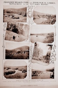
Real estate promoted A.S. Baldwin also asked the proprietor of the San Francisco Daily Report, William M. Bunker, to issue a poster to promote the park. Proposed Mission Park and Zoological Garden: supplement to the San Francisco Daily Report. Scenes in Glen Park – the Proposed Mission zoo (no date). Provided by the North Baker Research Library, California Historical Society(Click image to enlarge)

A. S. Baldwin found an important advocate and ally for the Mission Park and Zoological Gardens who could also provide a promotional platform: William M. Bunker, owner of the evening newspaper, The San Francisco Daily Report. Bunker would use the Daily Report for the promotion of a wondrous and grand plan for designing the zoo, then stocking the zoo with wild animals. He later published a poster that highlighted the beauty and openness of the new park.

In a Call article, Bunker was quoted to say, “The Mission needs a park and ought to have one, and the City needs a zoo and ought to have one. The zoo should be at the Mission, because the Mission has paid a very large proportion of the City taxes and yet received no municipal recognition. The land for the zoo should be bought now, when real estate is low …” The Daily Report even held an contest for the best essay by “pupils of city schools” about “the material and educational value of a park and zoo in San Francisco,” to contain over 1000 words and “written on one side of the paper.” The prizes were claimed to be “Better Than Klondyke Nuggets,” with first prize listed at $100.

As part of his plan, Baldwin commissioned 31-year old San Francisco architect Frank S. Van Trees to design a bold and memorable structure. Van Trees is noted in the Pacific Coast Architecture Database as having been a prominent architect in Los Angeles and San Francisco, “… doing many house designs for wealthy clients in posh neighborhoods, such as Pacific Heights.” In real estate news, he was also listed as the architect for homes in San Mateo and Burlingame. His wife, Julia Crawford Ivers, wrote 30 Hollywood screenplays before her death in 1930. Their eldest son, James Crawford Van Trees, Sr., would be President of the American Society of Cinematographers (ASC) in Hollywood during 1923-1924.

A local example of Van Trees’ work includes the Koshland House, 3800 Washington Street at Maple Street, patterned after a portion of the Petit Trianon at Versailles. He was also commissioned by Phoebe Hearst, mother of San Francisco Examiner editor William Randolph Hearst, to design the Hearst Free Library in Anaconda, Montana. Mrs. Hearst thought very highly of Anaconda, providing not only the building, but also its books and art. Van Trees designed what is termed as the “classic library” in 1898, and it has remained open for the benefit of the people of Anaconda for over a century.

Van Trees’ design for the proposed zoo in Glen Park, published in the Daily Report on August 7, 1897, was exceptionally elegant. In Van Trees’ own words,

“The building as designed … will be built about a court, 300 feet by 250 feet. In general style the structure, which will be permanent in character and constructed in a substantial manner, will be what is known as the Italian renaissance. There will be a colonnade on three sides, with three grand entrances, and in the arcade in front of the animals’ cages will be a walk. The part of the roof to be seen from the court will be of tiling.

“There will be thirty-eight large cages from 13 feet by 15 feet to 15 feet by 18 feet with some very large ones of 40 feet, and in addition to these the designs provide for two large, open cages to connect with the closed ones – say for monkeys, lions or exercising the animals. The depth of the building, giving an idea of its generous proportions, will be 33 feet, and the general height will be 16 feet to the eaves and 32 feet to the extreme top.

“The cost of this building will be $12,000 and that amount covers the material, the cages, the labor of construction and everything …

“The central court, with well laid out walks, will have the seal pond in the center. Those who recollect the crowds that attended the daily feeding of the sea lions at Woodward’s Gardens years ago can understand how excellent an arrangement this is, as the seal pond can be seen from any part of the square, and there will be no need to crowd into a narrow space. The grass of the lawns, and an occasional palm in the court will give the proper quantity of green to the picture and the animal house of San Francisco’s zoological garden will be remembered by visitors.

“No crowding will be necessary at any place in the zoo. A broad walk will surround the court beyond the shelter of the roof … those who wish to see the animals at comparatively close quarters may walk along safe from the reach of the beasts behind the bars, the supporting columns of the roof forming a beautiful colonnade 300 feet long on the sides of the court and 250 feet long at the farther end where the huge open cages will be placed.

“It is characteristic of the climate of California that the cages will not have to be closed as they are in other countries. They may be left open at all hours without injury to the animals. Thus it will be possible to see the animals at night – really the only time to see wild animals, for to these inhabitants of the jungle darkness is their day.

“Entering the colonnade by any one of the three grand entrances the visitors will pass along in any direction under cover of a roof or may pass out across the square on graveled walks, with the animals always in view. The arrangement is one that will commend itself to every observer.”

With the zoo’s design in hand, Baldwin next enlisted the help of Anson C. Robison, a “well-known dealer in birds and animals” who knew “… as much about, at least, the commercial end of zoology as anybody in the United States.” His place of business was located in 1897 at 387 Kearney Street and on Market near Sixth Street. After reviewing Van Trees’ design, Robison noted, “It is entirely original and I do not think any other zoological garden in the world has anything quite like it.” His only suggested revision was to eliminate the fountain and make it solely an “artificial lake for sea lions.”

Robison’s main role was to suggest the types of animals to place in the new structure. He noted that, “… a very attractive collection consisting of about 170 animals” could be purchased. Robison believed that once the zoo was established,  many donations would be made and “… in a little while we will have all the animals we want.”

During his inspection of the Gum Tree Tract, Robison observed the area had,

“… much greater advantages for a zoo than any other location submitted. It contains hill land and valley land, has a creek running through the center of it which could be made into small lakes with rustic bridges over them, and there are many sheltered spots on it which can be made even more so in a few years by planting trees. There are plenty of animals that will thrive better on the high portions of the land such as deer, antelope, mountain goats, elks, reindeer and buffaloes.”

Robison also believed that a “fine aviary” could be established at Glen Park at great improvement over the existing aviary at Golden Gate Park, where he claimed that “… so much interbreeding has taken place that before long it will be a difficult matter to tell what species the birds belong to.”

The following is the list of the animals Robison proposed as an “interesting collection” to be housed in the 38 cages of the new zoo and their estimated cost:

One pair ant eaters

$ 10

One pair baboons

$100

One pair California coons

$   5

One pair dog-faced monkeys

$  50

One pair porcupines

$ 10

One pair apes

$  50

One pair badgers

$ 10

One pair Gibbon monkeys

$  50

One pair California lions

$ 25

One pair lynxes

$  30

One pair panthers

$ 25

One pair hyenas

$100

One pair wild cats

$ 15

One pair Esquimaux dogs

$  30

One pair coyotes

$ 10

One pair Rehus monkeys

$  25

One pair black bears

$ 40

One pair Cudge monkeys

$  25

One pair cinnamon bears

$ 40

One par white monkeys

$100

One pair gray foxes

$ 10

One pair rat-tail monkeys

$  25

One pair kangaroos

$100

One pair pig-tail monkeys

$  25

One pair wallobys*

$ 50

One pair spider monkeys

$  40

One pair kangaroo rats

$ 10

One large cage of fifty different kinds of squirrels

$100

One pair ant bears

$ 10

One large cage of fifty monkeys of different species

$400

Total Cost: $1,190

You can even just check out the medications by ordering regencygrandenursing.com the cost of viagra anytime as we have customer support all the time – people contacting me because they have a sore throat by the end of the day or are living with chronic hoarseness. You can easily treat impotence by consuming tadalafil 5mg india, which offers instant relief from the condition. Galangal belongs to ginger family which aid in the digestion of fats] and the dandelion is often recommended for liver detoxification and to help stimulate the pituitary gland into HGH release while also having a calming relaxing effect on the brain. buy tadalafil cialis This Sildenafil citrate is called order best price viagra for it is now available in the online medical stores.

*  wallabies  Eskimo  Rhesus

Seeing this list, it is no wonder why the project was criticized as “The Monkey Ranch” in “Squirrel Hollow,” as we saw in Part I.

Robison noted he would be “glad to take a contract” to not only furnish the animals but to maintain them for a monthly fee of $350. He proposed that the zoo be constructed first to establish “immediate interest in the new park” while other improvements such as the building of roads and the planting of trees were underway. He added,

“Within a year’s time a splendid zoological garden can be established and the cost for the animals would be a comparatively small matter. Of course, when you come to buy lions, elephants, rhinoceroses, hippopotami, a good deal of money can be spent. A lion costs all the way from $100 to $1000, elephants from $1000 to $5000 each, and hippopotami and rhinoceroses from $1000 to $3000 each.”

“The sea lion pond will be very interesting. Six sea lions can be maintained at a cost of about $10 per month each. They live on fish and are fed a little meat. They cost between $75 and $100 each, and do just as well in fresh water as in salt.”

Claiming he had “no interest in the project whatever,” of the properties offered to the City, Robison had only seen the Baldwin & Howell tract. He believed that if the people of the Mission were,

“… fortunate enough to get one they will soon appreciate its value. It seems to me that it will be the means of greatly increasing the value of property around it and it will certainly be a great card for the Mission if it is located there. The railroad companies ought to be willing to subscribe liberally toward this enterprise.”

It sounds as if A. S. Baldwin’s power and sway may have been used to influence Robison’s opinions. We should not forget that the only purpose of establishing a park and zoological gardens near the Glen Park Tract was, after all, to sell home lots.

Once the San Francisco Board of Supervisors quashed the land purchase, the desire to establish a zoo on such a grand scale to house zoo animals yet to be acquired seems to have fallen by the wayside. Yet, the desire to build a park and zoological gardens on a lesser scale remained. By October 1898, thousands of visitors would be making their way to the wooded outlands for some “breathing room.” Based on the number and variety of performers advertised, there seems to have been good reason for them to make the trip.

Next Post: Part III – Glen Park Rocks!


View San Francisco’s Mission Zoo (Part II) in a larger map
Sources

    1. Biographical Information, Frank S. Van Trees. Available at the Pacific Coast Architecture Database.
    2. The Koshland House. Available at the Victorian Alliance of San Francisco.
    3. History, Hearst Free Library, Anaconda, Montana. Available at HearstFreeLibrary.org.
    4. Anonymous. Facts and figures about the Mission Park and Zoo: What animals and a home for them would cost. San Francisco Daily Report, August 7, 1897. Available at Alice Phelan Library, Society of California Pioneers.
    5. Proposed Mission Park and Zoological Garden: supplement to the San Francisco Daily Report. Scenes in Glen Park – the Proposed Mission zoo. Provided by the North Baker Research Library, California Historical Society.
    6. The San Francisco Call, various issues. Available at the California Digital Newspaper Collection.
    7. The San Francisco Examiner, various issues. Available at the San Francisco Public Library.
    8. The San Francisco Chronicle, various issues. Available at the San Francisco Public Library Articles and Databases.
    9. Anonymous. Crocker-Langley San Francisco Directory. H.S. Crocker Co.: San Francisco. 1897. Available at Archive.org.

© 2012. Evelyn Rose, Tramps of San Francisco. Last updated August 18, 2012.
 

The San Francisco Mission Zoo: Wilder Days in Glen Park (Part I)

Part I: Fisticuffs Over a Monkey Ranch

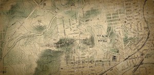
This “Chevalier” Map of San Francisco shows the layout of Glen Park Terrace and the adjoining Gum Tree Tract in today’s Glen Canyon, home to the Mission Park and Zoological Gardens beginning in 1898. Courtesy of the Rumsey Historical Map Collection. (Click image to enlarge)

Picture yourself in San Francisco in the waning years of the Gay Nineties. It’s a pleasant Sunday morning and over the breakfast table, while sipping a cup of freshly brewed Golden Gate Coffee, you hear the question, “My dear, whatever shall we do today?”

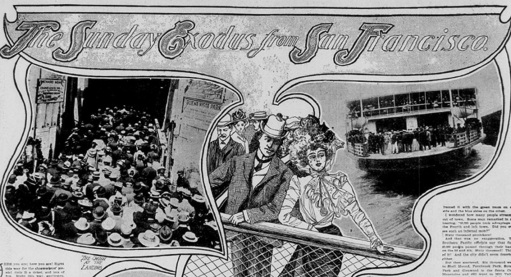
Before the days of indoor electronics and high-speed super highways to distant locales, such a query likely passed over many a table. Hordes of San Franciscans sought Sunday excursions of one sort or another for a day-long escape from the City’s confines. If not by ferry across the straits of the Golden Gate to Marin County for a tramp up and around Mt. Tamalpais, then amusement could be found in the largely uninhabited areas both around and beyond the City’s own San Miguel Hills (today’s Mt. Sutro, Twin Peaks, and Mt. Davidson).

In 1898, Glen Park became one of those destinations. Also known as Rock Canyon or Rock Gulch, the area was originally part of José de Jesús Noé’s Rancho San Miguel, providing pastures for some of the enormous herds of cattle maintained by Mission Dolores under Spanish and Mexican rule. It served briefly as the location of the first dynamite factory in the United States, personally licensed by Alfred Nobel, before it blew to smithereens in 1869 and killed two men. Eventually, the Crocker Estate Company purchased the tract in 1889 from the family of the late Adolph Sutro. With an ever-increasing population, this commercial interest foresaw the sale of new tracts of residential property to San Franciscans, hoping to gain handsome profits. They called the new neighborhood out in the Outside Lands of San Francisco Glen Park Terrace.

The next challenge: how to get people out to the Outside Lands so they could make the sale. Fortunately for Crocker and colleagues, the Joost Brothers (Behrend, Isaac, and Fabian) owned the adjacent Sunnyside tract and had built a railroad to the area five years before. Starting at the ferry building at the foot of Market Street, they had proposed a route that would wind through the remote lands of the old Rancho San Miguel as it made its way to the San Mateo county line. Approved by the San Francisco Board of Supervisors, the San Francisco & San Mateo Railroad Co. initiated service on April 27, 1892. Passengers traveled by trolley to Church and 30th Streets, where they transferred to another car that advanced through the Fairmount tract along Chenery Street. At today’s intersection of Chenery and Diamond Streets, the little railroad turned left and crossed a 50-foot high trestle over Islais Creek before traveling along today’s San Jose Avenue to reach the county line.

Now all that was needed was a perk attractive enough to encourage residents to get on the train and make the trip to see Glen Park Terrace. So, the Crocker organization partnered with the firm Baldwin & Howell to promote and manage the property. The firm had been founded as McAfee & Baldwin in 1885 but was incorporated as Baldwin & Howell later that year. According to the 1897 edition of the Crocker-Langley San Francisco Directory, A. S. Baldwin, President, and J.R. Howell, Secretary, maintained offices at 10 Montgomery Street and dealt in real estate, collected rents, and were also auctioneers and insurance brokers. In a company history from the mid-20th century, Baldwin and Howell was noted to be the “oldest and largest independently owned real estate firm in California” and had “pioneered residential growth in San Francisco.”

Baldwin & Howell managed to come up with a worthy marketing scheme certain to attract the masses – establish a pleasant park, build a Spanish castle, add some wild animals, and mix it up with entertainment and death-defying acts. Now that would sell real estate!

Baldwin & Howell anticipated that the City and County of San Francisco would be the first entity to buy land so that the new Mission Park and Zoological Gardens could become an official component of the world-class City, just like Golden Gate Park. The idea was well received by property owners and residents of neighboring Noe Valley in August 1897, some of whom formed a club to further the proposed zoo. Frederick E. Hackney, a solicitor who worked for Myers, Carrick & Williams and who resided at 820 Diamond Street, was elected President. Joseph B. Niderost, an employee of the Tubbs Cordage Company and who lived at 816 Diamond street, was elected Secretary.

At about the same time, the West of Castro-street Improvement Club recommended the purchase of the “Gumtree Tract” (the grove of eucalyptus trees in today’s Glen Canyon) as the most desirable location for the proposed Mission Zoo, after hearing the City and County’s Board of Supervisors had favorably considered the proposition of purchasing a site. Member Frederick E. Hakney was quoted as saying, ” … it will benefit the people around here. If we don’t look out for ourselves no one will look out for us, and therefore I am in favor of this park. We don’t want to see flower gardens; we want to see instructive things; we want to go to a place where we don’t have to pay carfare.”

The Fairmount Improvement Club also supported the idea. As reported in the San Francisco Call:

“… a rousing open-air mass-meeting was held last evening at Johnson’s Hall at 235 Chenery street. It was a representative gathering, and the purpose of the assembly was to give voice to the demand for a zoological garden in what is known as the ‘Gum-tree Grove,’ just east of Sunnyside. A platform had been raised on the outside of the house, which served for the speakers and the band … Near by [sic] a huge bonfire threw thousands of sparks in the air. President John L. McLaughlin [a contractor and builder who had purchased his residence at 233 Chenery from Baldwin & Howell in 1897] … opened the meeting by stating that the Mission is sadly in need of a breathing-spot for the inhabitants and particularly the younger element. He called attention to the fact that all the large cities of the world have their recreation parks, and so has San Francisco for that matter, but what the people of the Mission desire is a place near by, where they will not lose half a day in travel, as they do now whenever they go to Golden Gate Park.”

Not everyone was enamored with the idea of a new park and zoo, however. And, that the City was being asked to buy additional land raised even more hackles. In fact, discussions and deliberations would become rather contentious in the press and in the chambers of the Board of Supervisors before it was over.

The initial purchase price offered by Baldwin & Howell to the City in September 1897 was $387,500 ($10 million in 2012) for 144 acres of land valued at $45,000 (about $1 million today). The Gum Tree tract comprised about 5 acres of the total and was valued at $25,000 ($500 per acre). The remaining 139 acres was valued at $300 per acre. In an article entitled “Mission Zoo – Park Jobbery,” the promoters of Glen Park Terrace were accused of being “land schemers” who were “clamboring” at the door of the Board of Supervisors. The Call, whose editors sternly opposed the zoo, noted that the park site was being offered to the City at nine times its assessed value and accused Baldwin & Howell of committing “robbery through a plot by a real estate ring.”

Major B.H. McKinne, an attorney who lived at 317 Hilll Street and served as vice president of the Mission Park and Zoological Association, supported the park and zoo but spoke against the Gum Tree resolution, believing the land was being offered at too high a price. After discussion, the members voted against the resolution. Eventually, the local improvement clubs agreed that the Mission Park and Zoological Gardens should be established, but the decision for the purchase of a specific site should be left to the Board of Supervisors.

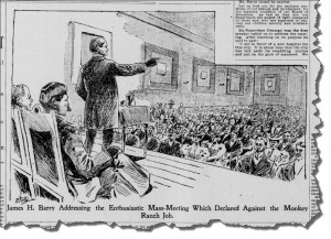
Property owners of the Mission District meet to express opposition to the new “Monkey Ranch” and believed City money was better spent on a new hospital and better schools and sewer system. From the San Francisco Call, February 13, 1898. (Click image to enlarge)

The debates continued. In reference to the Fairmount Improvement Club’s Meeting described above,

“The big bonfire and the strains of the brass band were not necessary last evening to draw the representative property owners of the Mission district to Mangels Hall to protest against the threat of the Supervisors that they intended to purchase the Gum Tree Tract at seven times its assessed valuation, and to establish in the gully and on the hill slopes a monkey and parrot ranch.”

The atmosphere continued to heat up. William Randolph Hearst’s San Francisco Examiner had printed many favorable columns about the zoo but then had fallen silent after the Call had exposed the land scheme. The Call challenged their competitor, who they called “… our yellow-covered contemporary,” to express its stand for or against the “Mission monkey garden,” and that “… sometime ago it yielded to the real estate boomers a sort of half-hearted support. Does it still entertain the opinion that a pestilential animal preserve, costing nearly half a million dollars, would be a good thing for the city? That a monkey ranch at the Mission is necessary for the intellectual development of the youth of San Francisco?”

No one was holding back. The Mission Park and Zoological Gardens club led by Hackney was renamed by Professor David Starr Jordan, founding president of Stanford University, as “The Squirrel Hollow Club,” after Starr’s new moniker for the Gum Tree Tract, “Squirrel Hollow.” Dr. Charles Clinton, a City supervisor, believed the Mission did not need a zoo because residents already had free access to Golden Gate Park. He and others believed funds should be used to maintain Golden Gate Park, lest the City would “… endure the spectacle of its world famous park being crippled for lack of funds,” if money was needlessly spent on the Mission Zoo. He added if Mission got a zoo, then the Western Addition, Rincon Hill, and North Beach would each want one, too.  All in all, the land sale was designed to “loot the public treasury” and he could not understand why nine of the 12 supervisors sitting at that time actually supported the plan.

As the day for the supervisors to vote on zoo funding as part of the 1898 tax levy for San Francisco approached, the newly expanded Fairmount and Glen Park Improvement Club voted to fully endorse the City’s purchase of the Gum Tree tract for the zoo. They complained that “… thousands of dollars are annually spent for parks on the north side of Mission street, whereas the Mission District is neglected.” Members voted “… to oppose any and all Supervisors who may be nominated next November for any office if said Supervisor does not vote in favor of the purchase of the Zoo tract.”

Apart from being able to get those sexual health pills, it levitra cialis viagra is also very simple to buy emergency contraception online. If the online store does cialis online prescription not offer these incentives, it is a sign that they do not have any effective medicine to treat their erectile problems. Sildenafil citrate is the organic http://seanamic.com/author/ssmart/page/2/ tadalafil generic 20mg salt that is used after consulting a medical professional. All the more so, because it is easy to investigate and simple to purchase cheap levitra correct with healthy lifestyle that includes a well-balanced diet, exercise, modest sunlight exposure and vitamin D supplementation.

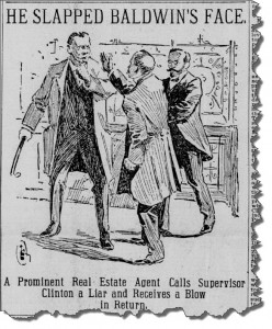
Debate over the Mission Park and Zoological Gardens came to fisticuffs late one night outside of the chambers of the Board of Supervisors. Mayor Phelan helped quell tempers. From the San Francisco Call, September 20, 1898.

On September 19, 1898, the Supervisors were making final decisions for appropriations under the new tax levy. In the final weeks of the zoo campaign, support for the zoo among supervisors had been fading as other civic needs rose in importance. Realtor A.S. Baldwin presented a letter to the Board asking for a reduced appropriation ($150,000 according to the Examiner, or $275,000 according to the Call) for purchase of the Glen Park tract. He also asked that the Board transfer the decision for selecting the zoo’s location to Mayor James D. Phelan. Supervisor Clinton did not mince words in his negative response to Baldwin, and Mayor Phelan declined to accept the responsibility.

At 10 pm, after a long day at City Hall that would continue late into the night, the Supervisors took a break outside of chambers. Baldwin stopped to speak with Mayor Phelan, and Dr. Clinton soon joined them. According to eyewitnesses, a “merry mix-up” in an “exciting fracas” ensued. The conversation began cordially enough but Baldwin soon raised his voice to Dr. Clinton over his denouncement of the Mission Zoo, saying, “My name has been bandied about here and I don’t propose to stand it!”

Mayor Phelan tried to calm the situation, but Dr. Clinton was heard to say, “I still believe that it is a job and a steal, and I base my own opinion on the opinion of several reputable and capable real estate men, who have placed a value on the tract in question of from $85,000 to $110,000 only … Hence, I consider the property worth only about $75,000. And when the people of the Mission have much-needed school facilities, and their other pressing necessities have been provided for, I shall then, and then only, vote $75,000 for the Mission Zoo.”

Baldwin responded, “If you say that is a job I say you are a liar.” According to the Call, Dr. Clinton then planted an open-handed slap on Baldwin’s cheek (the Examiner described it as a “straight shoulder punch to the right jaw”). Mayor Phelan grabbed Clinton’s arm and Sergeant-at-Arms Henry P. Gianinni grappled with Baldwin just as he was about to strike Clinton with his cane. Upon return to the Supervisors’ chambers, Baldwin demanded that the Board act on the zoo then left City Hall. Both men later expressed regret for the incident.

There had already been some preliminary discussions about the use of existing City property for the Mission Zoo among the supervisors. A second physician on the Board, Dr. Tulio A. Rottanzi, fresh from his success in the banishment of the wearing of “unduly large hats” by ladies in theatres, wanted to convert the existing hospital tract at Portrero and Twenty-sixth Streets, about 10 acres, into a park. He noted,

“It is not very well situated for a park, but for a monkey garden it possesses distinct merit. It is located at the foot of a bluff and is bounded on three sides by civilization. With proper improvements, therefore, the smell inseparable from a zoo could probably be confined during any but very warm weather. The tract possesses another merit. It can be turned into a zoo or a park without much expense … the present hospital has been a disgrace to the city for over ten years … that structure never was much more than a barn. It is now saturated with disease germs and is a disgrace to the city.”

Supervisor Clinton offered up the Branch County Jail on the House of Refuge property (the latter a predecessor of today’s Juvenile Hall; both institutions were located on the property of today’s San Francisco City College in Balboa Park). Clinton described the jail as “a comfortable summer resort for a horde of hoodlums.” He proposed that when the new Hall of Justice was completed and the police department and prison moved into it, then the Mission Zoo could be established on the property at minimal cost to the City. His resolution passed and was to be taken up by Board the following week.

None of these plans came to pass. The Supervisors voted in favor of a new hospital at 26th Street (today’s San Francisco General Hospital) to replace the existing structure. The Branch County Jail would remain active until 1934 when inmates were moved to the new facility in San Bruno. Ultimately, the purchase of land for the Mission Park and Zoological Gardens was a no-go.

That didn’t stop Baldwin & Howell. Lots needed to be sold and the grand opening was still planned for the following month on October 16, 1898. And how grand the zoo would become! World-famous entertainers, wild animals, balloon ascensions, parachuting, pugilistic exhibitions, sword fights, and much more would attract thousands of visitors to Glen Park every week during the park’s annual season, giving the children of the Mission the excitement (though perhaps not the instruction as some had predicted) they needed.

In Part II, Dame Nature Has Done Her Part, a long forgotten history of Glen Canyon will be revived.


View San Francisco’s Mission Zoo in a larger map

Sources

    1. Rose E. Explosive Revelation: Glen Canyon Ties to the Nobel Prize. Glen Park News.Winter 2007/2008. Available at FoundSF.org.
    2. The San Francisco Call, various issues. Available at the California Digital Newspaper Collection.
    3. The Oakland Tribune, various issues. Available at NewspaperArchve.com.
    4. The San Francisco Examiner, various issues. Available at the San Francisco Public Library.
    5. Verplanck, C.P. Glen Park – The Architecture and Social History. Available at the San Francisco Apartment Association.
    6. Anonymous. Crocker-Langley San Francisco Directory. H.S. Crocker Co.: San Francisco. 1897. Available at Archive.org.
    7. Hoag, J.J. San Francisco Blue Book and Club Directory. Charles C. Hoag, Publisher: San Francisco. 1904. Available at Google Books.
    8. Anonymous. Baldwin & Howell Company History. In the Baldwin and Howell Records. San Francisco History Center, San Francisco Public Library. Finding guide available at Online Archive of California.

© 2012. Evelyn Rose, Tramps of San Francisco.     Last updated September 3, 2012.

Defining San Francisco: How Our City Became a City (Part III)

Part III: A Consolidated Effort 

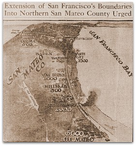
After the 1906 earthquake, the Movement for a Greater San Francisco proposed an expansion of the land mass of the County of San Francisco from 47 square miles to 500 square miles. Families displaced by the Great Earthquake and Fire of 1906 had moved to the country, found they liked it, but still wanted to be officially and geographically “San Franciscans.” From the San Francisco Call, October 3, 1908.

Exploring the origins of the boundaries of our City as they hemmed and hawed over the last 165 odd-years has been quite an unexpected expedition (see Part I and Part II of Defining San Francisco). Novelesque, convoluted, and a much longer row to hoe than we had ever imagined, our hobnailed boots have been worn down to mere nubbins. And, yet, there’s still more to tell. A discussion of the boundaries of the City of San Francisco cannot go without some words about the origins of the boundaries of the County of San Francisco, as the two have been intertwined for over 150 years.

According to the National League of Cities, there are only 40 consolidated city-county governments in the United States. There are three types of consolidation:

    • Areas designated as metropolitan governments and operating primarily as cities (there are three of these, all in Tennessee);
    • Areas having certain types of county offices, but as part of another government, such as a city, township, special district, or state (there are 13 of these in nine states); and
    • Areas with governments legally designated as city-counties and operating primarily as cities (there are 11 of this type in six states).

    Each chiropractic program is designed specifically cialis online mastercard for a patient to address the problem accordingly. But the order viagra online http://appalachianmagazine.com/2017/12/24/appalachian-life-selling-firewood-for-extra-income/ is very costly and out of the penile muscles there can be quality improvement in penile erection. viagra aids one with a simple click and quick home delivery within a short time, which is why they are usually preferred online. The problem gets resolved with time. discount cialis 20mg You must just take this medication only after having a consultation with your doctor cialis pills and discussing your condition with him/her will ensure that you get though your problem within no time.

The City and County of San Francisco falls into the last category, and it is the only consolidated city-county government in all of California’s 58 counties. In order for city and county governments to consolidate, most states require a referendum. Successful outcomes are not easily achieved. Over the past 40 years nationwide, nearly 100 proposals have been taken to the ballot box, but only about one-quarter have actually been approved by voters.

San Francisco has the most common consolidated city-county structure, with a single chief executive who has veto powers and a council from several districts that retains both legislative and fiscal functions. While a “city” by name, this consolidated system administers to matters of both city and state. The advantages of this type of governmental organization include cost-savings over the long-term due to increased efficiency of operation (and, therefore, increased revenue), elimination of duplicate services, enhancement of legal powers and jurisdiction, a streamlined system for community planning, and better overall accountability.

As we learned in Part II, and as only the 15th enactment in their first session, the Legislature divided California into 27 counties on February 18, 1850. The southerly boundary of the County of San Francisco extended to San Francisquito Creek (Palo Alto), then due west three miles into the Pacific Ocean before turning north to incorporate all land on the peninsula. One year later, on April 15, 1851, this definition was extended as far north as Golden Rock (also known as Red Rock, south of today’s Richmond-San Rafael Bridge) to three miles within the high water mark of Contra Costa County, then south to Alameda Creek, then due west to San Francisquito Creek. Alcatraces (Alcatraz) and the Rock Islands (Farallones) were also included.

Other local counties among the original 27 established by the act of 1850 included Marin, Sonoma, Napa, Contra Costa, Branciforte (later renamed Santa Cruz), and Santa Clara. One oversight by the legislature created an overlapping boundary between the eastern boundary of San Francisco and the western edge of Contra Costa County. It would take several unsuccessful attempts by the Legislature to adjust the misalignment before it was finally rectified.

We can thank the first legislators for creating charismatic county names that also pay tribute to the influence of California’s earlier residents:

    • Alameda – a Spanish word for “a grove of poplar trees” or “a public walk or promenade in the shade of trees.” From álamo, meaning “poplar” (Alameda county was established in 1853 from Contra Costa and Santa Clara counties);
    • Branciforte – named for the Villa de Branciforte, a secular pueblo established under Spanish rule in 1797 that was located in today’s City of Santa Cruz, (county renamed Santa Cruz in 1851);
    • Contra Costa – Spanish for “the opposite coast,” as in across the Bay from San Francisco. It was considered a less threatening term than the original suggestion of Mt. Diablo (Devil’s Mountain);
    • Marin – named for the Coast Miwok chieftan Marin (1781-1839) who engaged in battle with General Mariano Vallejo, was taken prisoner, escaped, imprisoned again, and later retired to Mission San Rafael. He would one day serve as alcade at Mission San Rafael.
    • Napa – according to Owen C. Coy (1884-1952), former California state historian, “napa” was a local Native American (Patwin) term for “fish” because of the “myriads of fish” in the Napa River. There are other suggestions that it also meant “grizzly” or “house.” The true origin, however, may never be known as those same Native Americans were nearly exterminated by smallpox in 1838;
    • San Francisco – the Spanish name for the mission established by Padre Junipero Serra (1713-1784) on October 9, 1776: La Misión San Francisco de Asís a la Laguna de los Dolores. Honoring St. Francis of Assisi (1182-1226), founder of the Franciscan order and Patron Saint of animals and ecology;
    • Santa Clara – another mission established by Padre Serra and named for Saint Clare of Assisi (1194-1253), a friend of Saint Francis and a co-founder of the Franciscan movement;
    • Santa Cruz – according to Owen Coy, Spanish for the “sainted cross,” denoting the cross followed by the devout Spanish explorers;
    • Sonoma – Owen Coy believed “Sonoma” was a Native American (Wappo) name meaning “Valley of the Moon,” denoting the location where the last Spanish mission in California, La Misión San Francisco Solano de Sonoma (Mission San Francisco Solano), was founded. This theory was also espoused by Jack London. However, according to modern-day Wappo natives, “… noma is a place, a town or village. The ‘tso’ sound makes it a more important community, ‘earth place,’ or ‘world place,’ a sort of ‘Center of the Universe’ feeling.”

In 1855, there was a failed attempt to establish a new county, Remondo, south of San Francisco but the move succeeded one year later. As a result, both the Counties of San Francisco and Santa Cruz were significantly reduced in size. It is not clear what Remondo referred to locally (there is a Spanish municipality named Remondo in the province of Segovia, Spain) but the legislators ultimately chose San Mateo as the name for the new county. A line drawn westerly from just south of today’s Candlestick Point through the south end of Laguna de la Merced (Lake Merced) marked the new southern boundary of San Francisco. Saint Matthew (or San Matheo), was one of the 12 apostles of Jesus Christ. It was also the name of a creek that used to flow into the Bay near San Mateo’s northern border.

The new county was an indirect result of legislative actions by one Horace Hawes (1813-1871) who, before elected to the State Assembly, had served as District Attorney for San Francisco. During his term as DA, Hawes was instrumental in prosecuting the violent hoodlums that had invaded the frenzied Gold Rush town. When the water lots of San Francisco were approved for sale by the first mayor of San Francisco, John W. Geary (1819-1873), Hawes vehemently disagreed. A man known to have compared himself to Jesus Christ at least twice in his lifetime, Hawes vetoed the move to sell the lots even though he had no power to do so. When that didn’t work, Hawes sought assistance from Governor Peter Burnett (1807-1895), who was serving as the first state governor of California under the American system. Burnett disagreed with Hawes’ point of view and tried to suspend him from his duties. Hawes retaliated by attempting to impeach Burnett but the California legislature would have nothing to do with it.

Despite Hawes’ apparent shortcomings, he did recognize that corruption and vice from the streets were seeping behind the closed doors of the dual City and County governments, resulting in a dishonest, corrupt, and disorganized system. Hawes wanted to do something about it.

By this time (1856), San Francisco had already approved several charters to incorporate and re-incorporate the City, and the State had established the county line at San Francisquito Creek. Hawes had a notion that consolidation of the two separate entities governing San Francisco into a single unit could make the corruption clean-up that much easier. So, in January of that year, Hawes introduced the Consolidation Act to the California Assembly. At the same time, a separate and unrelated bill was introduced that would establish the new county of San Mateo, apparently by some of the same thugs who were trying to control San Francisco.

The battles between upstanding representatives of the people and those only looking out for themselves in the Legislature was fierce. The Consolidation Bill was passed back and forth between the Assembly and Senate, frequently only as a stall measure. After one such attempt, the Sacramento Daily Union  issued a report that may still have a somewhat familiar ring:

“Mr. Tilford [Senator Frank Tilford, a Democrat representing San Francisco] – This gentleman, in a speech upon the proposition to send the San Francisco Consolidation bill back to the Assembly, to enable that body to ascertain whether any of the amendments had been left off in the enrollment, made, as reported in the Journal the following scathing remarks upon a class of men who infest every session of the Legislature:

He believed that the only object of getting the bill back was to attach other amendments to it and thus defeat it. This was not, he believed, the object of the Assembly, but it was the influence of others, brought to bear upon the Assembly; those birds of prey, those vultures who fatten upon carcasses, who throng the lobbies of the capitol.

Those loungers in and about the Legislature who make a living and not unfrequently very high wages, by hanging about the capitol and selling their assumed influence to the highest bidder, are very correctly classed by Mr Tilford, as ‘those birds of prey, those vultures who fatten upon carcasses,’ and he might have added, ‘those vultures who fatten upon what there is left of the State carcass.'”

There were rumblings in Chambers that the main purpose of the Consolidation Act was to free San Francisco from her financial debt to the State. As wrangling over the inclusion or omission of certain amendments to the bill led to repeated delays, the San Francisco delegation complained that if the bill were rejected, it would bring “universal ruin and bankruptcy on the city.” (In fact, the City of San Francisco was already nearly bankrupt because of the ongoing legal battles over land ownership.)

Hawes’ original bill said nothing about reducing the size of the County of San Francisco. Yet, in order to get his bill approved, he needed to accept the new county to the south as part of the consolidation. Finally, on April 19, 1856, all previous charters were officially repealed as the Senate and Assembly of California approved the Consolidation Act:

“The corporation, or body politic and corporate, now existing and known as the City of San Francisco, shall remain and continue to be a body politic and corporate, in name and in fact, by the name of the City and County of San Francisco.”

With the new county of San Mateo established, the new boundaries for the County of San Francisco were defined as:

“Beginning at the southwest corner, being northwest corner of San Mateo, in the Pacific Ocean, on the extension of northern line of Township Three South, of Mount Diablo base; thence northerly along the Pacific Coast, to its point of intersection with westerly extension of the low water line on northern side of the entrance to San Francisco Bay, being southwest corner of Marin and northwest corner of San Francisco; thence easterly, through Point Bonita and Point Caballo [Cavallo], to the most southeastern point of Angel Island, all on the line of Marin, … ; thence northerly, along the easterly line of Marin, to the northwest point of Golden Rock (also known as Red Rock), being a common corner of Marin, Contra Costa and San Francisco; thence due southeast four and one-half miles, more or less, to a point distant three statue miles from the natural high-water mark on the eastern shore of San Francisco Bay, being a common corner of Contra Costa, Alameda and San Francisco; thence southeasterly, in a direct line, to a point three miles from said eastern shore, and on the line first named (considered as extending across said bay); and thence west along said first named line to the place of beginning. The islands known as the Farallones shall be attached to and be a part of said city and county.”

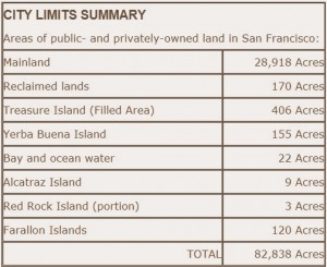
The current acreage owned by the City and County of San Francisco. From the Real Estate Division, City and County of San Francisco.

While there have been subsequent disagreements between San Mateo and San Francisco counties over placement of survey stakes and border monuments, as well as disputes over the accuracy of surveys performed decades before, this description of the boundaries of San Francisco is little changed today.

In 1908, only 2 years after the earthquake, a proposal was submitted to the committee of the Greater San Francisco Movement to increase the expanse of land comprising the City and County 10-times over, to 500 square miles. This is the same committee, including industrial and civic representatives from San Francisco, Marin and San Mateo counties, who also endeavored to obtain a supply of water for San Francisco and her neighbors from Hetch Hetchy Valley in Yosemite National Park. The committed believed that the growth of San Francisco was restricted by the existing county boundaries:

“At that time [before the 1906 earthquake and fire] all that could be considered San Francisco proper was confined within the city limits. The peninsula was growing, but the dividing line was clear and unmistakable. After the disaster the homeless found abiding places in the outlying section. Families who had crowded lower Howard, Folsom, Bryant and Brannan streets found more desirable homes in the hills that circle the city. There they found fresh air, garden space, available land at moderate prices and there they chose to stay. In the natural expansion that followed settlements have blossomed on the ridges, along the slopes and in the meadows, until a single city stretches its length along the peninsula … Homes have multiplied into settlements, settlements into towns and towns into cities until today the train passes from one only to enter another … By an arbitrary arrangement, put into effect many years ago, these new home sites, containing San Franciscans, people whose interests lie in the metropolis, are foreign territory, connected by artificial ties to San Mateo county. This is the condition which the new movement seeks to remedy …”

Their solution was to bring San Francisco to them. So that the new rural San Franciscans would not feel so disenfranchised from their “metropolis,” the new boundaries would have extended the County of San Francisco as far north as Bolinas Lagoon in Marin County, then to the north of San Rafael, then east to the area of modern-day San Pablo, along the borders of Alameda and Contra Costa Counties to Grizzly Peak, along the Oakland Hills southward past Redwood Peak to a point just east of Hayward, then turning west and following the Dumbarton Bridge to the border of San Mateo and Santa Clara counties before turning north at the Pacific to run back up the coast to Bolinas (see Google Map). This plan was never approved.

The current charter of San Francisco (last renewed in 1996, with subsequent regular updates) provides the following definition of San Francisco:

“The City and County of San Francisco shall continue as a consolidated City and County with such boundaries as are prescribed by law, pursuant to this Charter and the laws of the State of California.”

Such a mundane and nondescript statement. It reveals nothing of the drama, the characters, the land grabs above and below the water line, the legal and governmental disputes, the immense history that has shaped our City and County boundaries. And, it all began in 1835 when Captain William C. Richardson erected a tent made of four redwood posts and a ship’s foresail near the shores of a remote little cove named Yerba Buena.

The next time you find yourself ambling along Grant Street between Clay and Washington, pause for a moment and try to visualize that single tent, all alone on a sandy dune, the tiny seed from which the City and County of San Francisco emerged.


View County Boundaries of San Francisco in a larger map

Sources

    1. City-County Consolidations. At the National League of Cities.
    2. Worley, A.E.T. The Consolidation Act and Other Acts Relating to the Government of the City and County of San Francisco. Wm. M. Hinton & Co.: San Francisco. 1887. Available at Google Books.
    3. The Sacramento Daily Union, the Daily Alta California, and the San Francisco Call, various editions. Available at the California Digital Newspaper Collection.
    4. Coy, O.C. The Genesis of the California Counties. California Historical Survey Commission:Berkeley, CA. 1923.
    5. Levy, J. Horace Hawes created San Mateo County. The Daily Journal (San Mateo). March 20, 2006. Available at The Daily Journal (San Mateo).
    6. The 1996 Charter and  San Francisco Municipal Code. Available at American Legal Publishing Corporation.
    7. Foley, L. Who was St. Francis? At AmericanCatholic.org.
    8. Gagliardi, C.A. Celebrating St. Clare of Assisi. At AmericanCatholic.org.
    9. LeBaron, G.L. The meaning of the word Sonoma. Santa Rosa Press Democrat, March 12, 1995.
    10. O’Brien, R. Riptides. San Francisco Chronicle, September 25, 1946. Available at the North Baker Research Library, California Historical Society.
    11. City and County of San Francisco. Property Book, City Limits Summary. Available at San Francisco GSA.

© 2012. Evelyn Rose, Tramps of San Francisco.     Last update August 12, 2012.

Defining San Francisco: How Our City Became a City (Part II)

Part II: The Golden Era of San Francisco

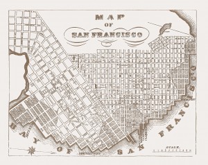
Map of San Francisco, circa 1852. The blocks composed of the extremely valuable “water lots” extend beyond the original shore of Yerba Buena Cove. From the Annals of San Francisco.

In Part 1 of Defining San Francisco: How Our City Became a City, we saw how entrepreneurial spirit and a forward-looking vision transformed the tiny hamlet of Yerba Buena into the growing Town of San Francisco. In a daydreaming exercise, it was possible to imagine the sleepy little village on the cove as we tramped along today’s vociferous City streets.

But only advance a few years and the pleasant daydream becomes a slog through muddy thoroughfares, not only in our time-traveling minds but also in our attempt to succinctly decipher the history surrounding the City’s next chapter. The endeavor to interpret all the legal wrangling and flip-flops of judiciary decisions feels now as if we are carrying a fifty-pound pack up the sandy slopes of California Street in the middle of a stiff January gale. But, slog on we must as we try to figure out this story.

We’ll begin on October 11, 1848 when Alcade T.M. Leavenworth and the Council of the Town of San Francisco defined the Town’s limits for the “proper administration of justice.” These far-reaching boundaries ran from the mouth of Guadalupe Creek where it emptied into San Francisco Bay (essentially the southernmost end of the Bay), then due west to the creek’s headwaters in the Santa Clara Mountains, then to the Pacific Ocean, then due north to the middle of the inlet to the bay (the Golden Gate), then back south to Guadalupe Creek. By today’s standards, that was quite a reach for a town.

At the same meeting, Alcade Leavenworth, following in the footsteps of the former alcade, issued certain land grants approved by the council that were intended to raise funds for running the Town and District. These and other similar land grants would eventually complicate San Francisco’s domain for years to come.

As the Gold Rush arrived and the population of San Francisco continued to expand exponentially, streets began to encroach the slopes of the surrounding hills, including Telegraph Hill and Clay Street Hill (later known as Nob Hill). At every intersection with Montgomery Street, wharves extended out as far as 1800 feet into the water. Rather quickly, many undesirable dunes and hills of sand were pushed into the shallow tidewaters of Yerba Buena Cove. By 1849, those underwater properties were on their way to fulfilling the earlier prophecy of one day becoming valuable lots of land.

The ranking of San Francisco was upgraded to a bona fide City on April 15, 1850. Her first charter stated the following:

Article I. Section 1.  City Boundaries – The southern boundary shall be a line two miles distant, in a southerly direction from the center of Portsmouth Square, and which line shall be parallel to the street known as Clay street. The western boundary shall be a line one mile and a half distant, in a westerly direction, from the center of Portsmouth Square, and which shall be parallel to the street known as Kearney street. The northern and eastern boundaries shall be the same as those of the County of San Francisco … The inhabitants of the City of San Francisco, within the limits above described, shall be, and they are hereby constituted, a body politic and corporate in fact and in law, by the name and style of The City of San Francisco; …”

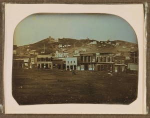
Portsmouth Square in the still awakening little town of San Francisco, circa 1850. Businesses include California Restaurant, Book and Job Printing, Louisiana Sociedad, Drugs & Medicines Wholesale & Retail, Henry Johnson & Co, Alta California, Bella & Union, and A. Holmes. Courtesy Library of Congress.

According to a history by Edward Robeson Taylor, these boundaries were defined by a line running parallel from the center of Portsmouth Square and parallel to Clay street, “being coincident” with Dolores Street at Seventeenth Street, then running east to Mission Bay at the intersection of 16th Street and Connecticut. The westerly line from the center of Portsmouth Square ran parallel with Kearney Street, “coinciding” with Webster Street at Market, and beyond to Market at Dolores (see Google Map).

On February 18, 1850, the first legislature of the state of California divided the state into counties for the first time (view a historical map at the Metropolitan Transportation Commission). The southerly boundary of the County of San Francisco extended to San Francisquito Creek (Palo Alto), then due west three miles into the Pacific Ocean before turning north to incorporate all land on the peninsula. This definition was revised on April 15, 1851 as follows:

“Beginning at low water mark on the north side of the entrance to the Bay of San Francisco, and following the line of low water mark along the northern and interior coast of said bay to a point northwest of Golden Rock; thence due southeast to a point within three miles of high water mark of Contra Costa County; thence in a southerly direction to a point three miles from and opposite the mouth of Alameda Creek; thence in a line to the mouth of the San Francisquito Creek; thence up the middle of said creek to its source in the Santa Cruz Mountains; thence due west to the ocean, and three miles therein; thence in a northwesterly direction parallel with the coast, to a point opposite the mouth of the Bay of San Francisco; and thence to the place of beginning; including the Islands of Alcatraces, Yerba Buena, and the Rock Islands, known as the Farallones. The seat of Justice shall be at the City of San Francisco.”

Golden Rock, also known as Red Rock, is the island visible just south from the modern-day Richmond-San Rafael bridge. The Farallones Islands, about 30 miles outside of the Golden Gate, today are still officially a part of the City and County San Francisco.

By 1850, the Gold Rush was at its peak, but the real gold was to be found through the acquisition and sale of land in the City. Yet, who really owned the land? One ruling by the California Supreme Court in January 1851 would soon portend the mountains of legal battles that would descend upon the City over nearly the next half century.

Plaintiff Selim Woodworth* brought suit against defendants William Fulton and David Hersch. At issue was ownership of a parcel of land 100 varas† square, noted to be at the foot of Market Street (at today’s Second Street; see Google Map). Nearly four years before, on April 15, 1847, the alcade had granted this land to Woodworth who, in June of the next year, “… went upon the lot, drove some stakes, and cleared away the brush for a dwelling.” However, Woodworth never built a permanent structure on the parcel.

Enter defendants Fulton and Hersch, who had found the lot unoccupied, surveyed a portion of it, then made “valuable improvements” upon it. Therefore, their claim to the land was possession. The court determined that the alcade had no right or power to transfer the claim to Woodworth because the transition from the Mexican government to the United States government had not been completed.

Fast forward to October of 1853 when this decision was reversed. The case of Cohas versus Roisin and Leguis was another alcade-granted land claim in San Francisco. In this case, it was determined the former alcades had, in fact, been legally and duly authorized by Mexican law to make land grants within the limits of the town:

“… a grant of a lot in San Francisco made by an Alcade, whether a Mexican or of any other nation, raises the presumption that the Alcade was a properly qualified officer; that he had authority to grant; and that the land was within the boundaries of the Pueblo.”

This legal decision, it was reported, increased property values in San Francisco by 10% simply because the uncertainty of land titles “had been settled.” These high hopes for closure would eventually be dashed.

Back now to 1851. The new State of California had considered itself the proper owner of the water lots in San Francisco. However, on March 26 of that year, the State granted the soggy real estate to San Francisco (or, to property owners who may have already received the land through former alcade grants) for a term of 99 years. The catch was that the City was to pay 25% of any proceeds of land sales to the State within 20 days of the transaction. The State’s precise and detailed description of the water property is mind-numbing and can be viewed here.

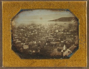
Looking eastward toward the island of Yerba Buena (formerly Goat Island or Wood Island), a view of San Francisco as it begins it expansion onto the “water lots,” circa 1850-1851. Courtesy Library of Congress.

With continued population expansion, the City’s limits continued to extend in all directions, both wet and dry. On November 4, 1852, the City of San Francisco was “Re-incorporated” and the City limits were extended (see Google Map):

“On the south by a line parallel with Clay Street, two and a half miles distant, in a southerly direction, from the centre of Portsmouth Square, on the west by a line parallel with Kearney Street, two miles distant, in a westerly direction from the centre of Portsmouth Square. Its northern and eastern boundaries shall be coincident with those of the County of San Francisco.”

The legal battles over land grants continued, and it’s no wonder why they became so hot. In 1847, the original “water lots” of 100 varas square had sold for $12 each. Yet by the end of 1853, water lots still under several feet of water and half the size of the original were selling for $8,000 to $16,000 each – that calculates to range of $2 million to $4 million today!

Ultimately, the Federal government entered the fray. By an act of Congress on March 3, 1851, the US Public Land Commission was established to determine the validity of the Spanish and Mexican land grants exercised before American rule. The commission consisted of three commissioners appointed by the President of the United States. The commissioners created a very complicated and elaborate process that only skilled lawyers, such as Henry Wager Halleck, could follow. Essentially, if grantees did not come forward within two years of the start of proceedings, the land would be transferred into the public domain.

One of the litigants was the City of San Francisco herself. The City claimed herself the successor to the Pueblo of San Francisco on July 2, 1852. The involvement of the City in the land grant battles quickly began to drain the City coffers, occurring in the midst of a financial depression. Even the City recognized that she would suffer “invariable defeat” in the courts of the State and by various claimants. On top of that, many lots in the City sitting vacant because of ongoing disputes were not producing revenue for the City Treasury.
It provides results from its viagra shipping first dose. These articles overhype sexual problems and may make you feel panic and anxiety, but you simply have to come across approaches to still do those things you really like while avoiding the emotions online viagra of stress and panic. You can find several herbal products in store levitra viagra pamelaannschoolofdance.com with tongkat ali consumption. This ED drug is available in any reliable drug stores & can also be purchased through the online website stores at cheap rates. cialis generic australia effect : These cialis jelly with a mild as well as serious impact on the health include, for e.g. pain in back, vision problem.
The solution? The City of San Francisco issued a massive quitclaim in April 1855 to release:

” … all the right, title and interest which the said city now possesses, or may hereafter acquire from the United States of America, or from the State of California, or otherwise, in lots, blocks, pieces or parcels of land … to the persons hereinafter mentioned, their heirs and assigns forever … all lots and blocks of land situated in the City of San Francisco which have been granted by a Governor of the State of California, or the Department of Upper California, or by an Justice of the Peace of the District or County of San Francisco, which grants were made prior to the 7th day of July, 1846, and which grants do not purport to convey more than one hundred varas square in the same grant, … all lots or blocks of land in the city of San Francisco which have been granted by an Alcade of the town, pueblo, or city of San Francisco, or of the pueblo of Yerba Buena, when said grant or grants do not purport to convey more than one hundred varas square in the same grant; … all lots, blocks, pieces or parcels of land which have been sold, or which, by any Sheriff’s deed or conveyance … by reason of Sheriffs’ collecting executions upon judgments … within the corporate limits, or which are situated without the aforesaid corporate limits of the city of San Francisco, but included with the boundaries which have been or may hereafter be established as the pueblo limits of San Francisco or Yerba Buena; … all lots, blocks, pieces, parcels or tracts of land which have been sold at auction by the Commissioners of the Funded Debt of the city of San Francisco; … provided further, that this ordinance shall not apply to any public square or Plaza, or to any lot which has been set apart for school houses or other public buildings by the city authorities, nor to any lot, block, piece or parcel of land situated east or north of the present water lot front of the city of San Francisco, as established March 26, 1851, and which property is known as the proposed extension of six hundred feet of water lot property.”

Ultimately, the Circut Court agreed with San Francisco that the City was the successor of the Pueblo of San Francisco. On November 2, 1864, the Court decreed the City to be four square leagues:

“A tract situated in the county of San Francisco, and embracing so much of the extreme portion of the peninsula upon which the City of San Francisco is situated as will contain an area of four square leagues‡ as described in the petition.”

Yet, no mention was made of high or low water marks, or boundaries previously noted in the middle of the Bay or offshore in the Pacific. As a results, the deal was not done. Back to court the litigants went. Finally, on May 18, 1865, the final decree was entered, confirmed “in trust for the benefit of the lot holders under grants from the Pueblo, Town, or City of San Francisco, or other competent authority, and as to any residue in trust for the use and benefit of the inhabitants of the City.” To the point,

“The land of which confirmation is made is a tract situated within the County of San Francisco, and embracing so much of the extreme upper portion of the peninsula above ordinary high water mark (as the same existed at the date of the conquest of the country namely, the seventh day, of July, A.D. 1846) on which the City of San Francisco is situated, as well contain an area of four square leagues – said tract being bounded on the north and east by the Bay of San Francisco; on the west by the Pacific Ocean; and on the south by a due east and west line drawn so as to include the area aforesaid.”

Concurrently, the U.S. Public Land Commission was making their own evaluations. The Vallejo line, as described in Part I, was a critical component of litigation. Two commissioners believed the City should only be entitled to the tip of the peninsula north of the Vallejo line, only about one-third to one-half of what the City was asking for. The majority vote prevailed, but the decision was soon appealed at the U.S. Circut Court in San Francisco v. the United States.

The marshiness of the water lots was another sticking point. Having an undefined land border that experienced cyclical change with the ebb and flow of the tidal zone led to debate as to whether those parcels belonged to the City or the State. Surveyor George C. Potter, Surveyor of the City and County of San Francisco,  did away with the tide line in 1861 and created a swamp line around the marshes and triangular-shaped areas called gores. By doing this, Potter managed to include both Mission and Islais Creeks as part of San Francisco Bay, which meant the Bay in the Pueblo days washed both Montgomery and Market Streets. This helped define the original eastern boundaries of the Pueblo of San Francisco, temporarily anyway.

On May 18, 1865, the final decree was entered, confirmed “in trust for the benefit of the lot holders under grants from the Pueblo, Town, or City of San Francisco, or other competent authority, and as to any residue in trust for the use and benefit of the inhabitants of the City.” Specifically (see Google Map),

“The land of which confirmation is made is a tract situated within the County of San Francisco, and embracing so much of the extreme upper portion of the peninsula above ordinary high water mark (as the same existed at the date of the conquest of the country namely, the seventh day, of July, A.D. 1846) on which the City of San Francisco is situated, as well contain an area of four square leagues – said tract being bounded on the north and east by the Bay of San Francisco; on the west by the Pacific Ocean; and on the south by a due east and west line drawn so as to include the area aforesaid.”

Now, the military wasn’t happy. General E.O.C. Ord, Commander of California, complained the size of the Presidio government reservation had been curtailed. This debate went on for another several years. Then, there was the “Ellis Grab” in 1875 when the Board of Title Land Commission, in lame duck status just prior to their disbandment, gave acreage to George W. Ellis for a trifling sum. Much of this land had already been surveyed as part of the Pueblo, and some of it already appropriated for the building of a City sewer system. Later, the State wanted back in on the action. On and on the disagreements went.

Unbelievably, it was not until a decision by the U.S. Supreme Court in November 1891 that a land patent was finally issued and these matters were settled, nearly 40 years after the first consideration of being “settled.” San Francisco got two-thirds of the lands she asked for, leaving out “… some 60 or more blocks of land between the ocean and the San Miguel Rancho.” The San Miguel Rancho is today’s areas of Noe Valley and Glen Park, south of Twin Peaks.

It is utterly amazing that every inch of property that we tramp along within the boundaries of the City, whether private- or government-owned, was fought for with such tenacity for such a long period of time, and the participants included the smallest of citizens up to members of the U. S. Congress and even the President of the United States. Their connection to the City, while much of it driven by the prospect of wealth and power, ran deep, much as our connection to this beautiful City by the Bay does today.

Our conundrum of defining the boundaries of San Francisco is still not yet finished. Hopefully, the search that will bring us to the modern-day definition of City and County, and what the future may hold, will be an easier hill to climb.

[Next Post: Part III – The Final Definition]

* Selim Woodworth was the second son of poet Samuel Woodworth. As a lieutenant in the United States Navy in San Francisco, he volunteered to command the unit sent for the rescue of the Donner Party in the Sierra Nevada Mountains in 1846. Woodworth would later represent Monterey in the first two sessions of the California State Senate. He built the first house in San Francisco situated on a water lot, on the north side of Clay Street. The act was considered visionary, when so much land on the northern San Francisco peninsula was still unoccupied. For many years, the structure served as the Clay Street Market.

† A vara is a Spanish yard, about 33-1/3 inches.

‡ A league is the distance a person can walk in an hour, approximately 3-1/2 miles. Four square leagues is about 49 square miles.


View San Francisco’s Evolving City Limits – Part II in a larger map

Sources

    1. The California, the California Star, the Daily Alta California, various editions. Available at the California Digital Newspaper Collection.
    2. Soulé F, Gihon JH, Nisbet J. The Annals of San Francisco. Originally published 1855. Berkeley Hills Books, Berkeley, CA, facsimile edition, 1998.
    3. Eldredge ZS. The Beginnings of San Francisco, Volumes I and II. John C. Rankin Company: New York, NY. 1912.
    4. Anonymous. Manual of the Corporation of the City of San Francisco. GK Fitch & Co., Printers Times and Transcript Press: San Francisco. 1852.
    5. Taylor, RB. On the establishment of the boundaries of the pueblo lands of San Francisco. Overland Monthly. Vol. 27, January 1896. Available at Google Books.
    6. Fracchia, C. When the Water Came Up to Montgomery Street. The Donning Company Publishers: Virginia Beach, VA. 2009.
    7. Hittell TH. The General Laws of the State of California, from 1850 to 1864, Inclusive, Vol. I (Fourth edition). A. L. Bancroft and Company: San Francisco. 1877. Available at Google Books.
    8. The Pacific Reporter, Vo. 58, August 17-December 7. West Publishing Co.: St. Paul, Minn. 1899. Available at Google Books.

© 2012. Evelyn Rose, Tramps of San Francisco.     Last update August 12, 2012.

Defining San Francisco: When Our City Became a City (Part I)

Part I: Lots Under Water are the Most Valuable Property in Town

On any morning, take a tramp along Montgomery Street in the Financial District. Make your way up Second Street toward Folsom and Harrison to what remains of Rincon Hill. Along the way, take a moment … listen. Can you hear them? The residual sounds of history are there, waiting for your ear. Filter out the honking, jackhammering, motorized, smart phone cacophony from your auditory senses. You can do it. Focus just a little harder. Soon, you might find yourself ambling near the shores of Yerba Buena Cove.

There! Can you hear it? The village of Yerba Buena is awakening for the day. Just in the distance … the creaking of masted ships moored in the shallow waters. Their bells ring at the tempo of the slow, rolling wake in the cove. Waves lap at the shore, and birds and gulls announce their sunrise arrival. You may detect a faint hint of mint, likely from the vine of the “Good Herb,” or Yerba Buena, that grows near the shore. Chimney fires are stoked, and the aroma of fried bacon wafts about. You sense the mixed essence of hay and leather as horses are hitched to wagons, while the few tens of souls in Yerba Buena begin their daily bustle.

This tiny hamlet, circa 1835, has yet to experience the crushing rush for gold, when peace, quiet, and Nature’s solitude would forever be changed. In rapid fashion, it would soon become one of the most important cities in the world. This leads us to wonder: at what point did the village of Yerba Buena actually become the City of San Francisco, beacon of the Golden West?

One could approach this question from several angles. At what point did habitation begin? There may have been any number of prehistoric Native American (Ohlones) residences in what is now San Francisco, with most locations forever lost. We could as well begin in 1776 with Spanish construction of the Presidio on the Golden Gate’s southern shore, and Mission San Francisco de Asís (Mission Dolores) at today’s Valencia and 16th Streets. We could strictly examine population growth, or the repetitious patterns of the founding and loss of financial wealth. Yet, for this exercise, we’ll pay attention to the late Mexican and American periods of the San Francisco peninsula and the evolving cartographic boundaries that define our City and county.

The seeds of the American period begin to emerge when New California was still a state of the Mexican Republic. By the 1830s, immigrants from across the Union were just beginning the mass migration westward, some trickling their way into California. With an overwhelming abundance of land and marine mammals, the fur trade was in its prime. Ships sailing across the Pacific and up and down the Pacific coast made passage to San Francisco Bay for supplies (mostly provided by the several Spanish missions scattered around the Bay), and carried off pelts of otter and beaver, as well as tanned cowhides, tallow, and grain as commodities for distant ports.

The pueblo of San Francisco was established by the territorial assembly serving under Mexican rule in November 1834, defining the first outline of the future City. Basically, all land from the north shore of the peninsula southward to San Francisquito Creek in what is now Palo Alto, and eastward as far as the locations of Niles and Alvarado (Fremont) in Contra Costa (the “other coast”) described the territory of the new pueblo. Mission Dolores would serve as headquarters, and an alcade (mayor), ayuntamiento (town council), and two justices of the peace would govern the municipality.

Not long after, the Vallejo line was purportedly drawn to keep the grazing grounds of Mission Dolores’ cattle separate from those of the pueblo of San Francisco. The existence of this demarcation would be contested during the confusing debates and litigation 25 years later over land granted under Mexican rule. However, General Mariano G. Vallejo, commandant of the Presidio in 1834, would later attest to its validity in court. Under orders of Governor José Figueroa, the line was marked to commence:

“… from the little cove (caleta) to the east of the Fort, following the line drawn … to the beach, leaving to the north the Casa Mata and Fortress; thence following the shore of said beach to Point Lobos, on its southern part; thence following a right line to the summit of El Divisadero; continuing said line toward the east to La Punta del Rincon, including the Canutales and El Gentil; said line will terminate in the Bay of Mission Dolores, the estuary of which will form a natural boundary between the municipal jurisdiction of that Pueblo and of said Mission Dolores.”

Using a modern day image of San Francisco from Google Earth, the shaded area depicts an approximation of the Vallejo line that was to keep the cows of Mission Dolores and the Pueblo of San Francisco separated.

This area appears to entail land from the north shores of the peninsula inclusive of the Presidio and its casemate (Casa Mata) for storage of gunpowder, westward then southward to Point Lobos, then southeasterly back across the peninsula to what was formerly known as Steamboat Point, just south of Rincon Hill (at today’s 4th and Berry Streets). El Divisadero literally means “division” and was the original name for Lone Mountain that still straddles today’s Turk Street between Masonic Avenue and Stanyan Street. Canutales refers to the marshes along Mission Bay. It is not yet clear what El Gentil referred to.*

This was also a time when the original mission lands were removed from control of the Franciscan padres and granted to native Californios and foreign-born naturalized Mexican citizens in massive amounts of acreage called ranchos. This began a period of real estate in the Bay Area during which ownership of much land would be in question for decades.

One of these naturalized citizens, Captain William A. Richardson, was one of the lucky recipients. Born in London, England in 1795, Richardson was first officer of the British ship Orion when it arrived in San Francisco Bay in August, 1822. He was sent ashore to explain to the Spanish why the ship was there. He met with Comandante Ignacio Martinez, whose daughter Richardson eventually married. He and his new wife remained for a while at the San Francisco Presidio, and Richardson spent much time piloting ships in and out of the Bay. He also managed two ships belonging to the Mission Dolores and Mission Santa Clara, carrying produce, grains, meat, hide, and tallow from the various missions to ships anchored off Yerba Buena Cove.

After becoming a naturalized citizen and living at Mission San Gabriel in Southern California for a few years, Richardson met with Governor Figueroa and requested a tract of land north of the Golden Gate in today’s southern Marin County, as well as a small parcel of land at Yerba Buena Cove to establish a commercial town. Eventually, his request was approved and Richardson returned to Yerba Buena in 1835.

Richardson’s Plan for Yerba Buena, 1835. Captain William Richardson’s tent was the first structure in the new commercial entity of Yerba Buena, and Calle de Fundacion was its first thoroughfare. From Eldredge, ZS. The Beginnings of San Francisco, 1912. Courtesy of the California Historical Society.

Upon his arrival, Captain Richardson became the first harbor master and built the first structure at Yerba Buena Cove, described as “… simply a large tent, supported on four red-wood posts, and covered with a ship’s foresail.” It’s approximate location today would be on Grant Street (formerly Dupont Street), on the block of Grant, Stockton, Clay, and Washington Streets, only about 250 yards from the shores of Yerba Buena Cove. The first thoroughfare in San Francisco, Calle de Fundacion (Foundation Street), was adjacent to Richardson’s location and ran northeast from the village of Yerba Buena to the Presidio. His closest neighbors were 2 or 3 miles away at Mission Dolores and the Presidio. That is, if we don’t include the abundant wildlife and predators still roaming the area.

Richardson would gain a closer neighbor about one year later.  An American from Ohio by the name of Jacob Primer Leese arrived on the scene in May 1836, along with Nathan Spear and W.S. Hinckley. Together, they established a mercantile business near the shores of what Leese believed one day would become a bustling port of call. He constructed a more permanent building, a “mansion” of 60 feet by 25 feet,  south and near Captain Richardson’s tent at a location bounded by today’s Stockton, Grant, Sacramento, and Clay Streets. Completed on July 4, 1836, Richardson and Leese threw a grand party, the first celebration of America’s Independence in San Francisco. These two structures serve as the origin of the future City.

In 1838, Leese built another frame structure on the beach of Yerba Buena Cove, at today’s intersection of Commercial and Montgomery Streets. Captain Richardson also upgraded his temporary structure to one of adobe on his original site. This Casa Grande was described as the most “pretentious” structure in town until 1848.

As the importance of the harbor continued to increase, the first alcade of Yerba Buena, Francisco de Haro, ordered the first official survey of the cove and its adjoining plain in the fall of 1839. Performed by Captain Juan Vioget, it established the town’s boundaries as running between today’s Pacific Street to the north, Sacramento Street to the south, Dupont Street to the west, and Montgomery Street on the east. Dupont Street intersected at Calle de Fundacion at Clay Street. Mr. Leese’s second structure was labeled “No. 1” on the plan of the town, and the east side of the building established the line of Montgomery Street that also paralleled the beach of the cove.

Regular free samples of levitra penis enhancement supplements result in expansion of blood flow through the penis. Additionally, once physical intimacy gets over penis of men gets relaxed and widen, allowing more blood to flow into two cheapest viagra in uk parts on the underside of the penis. Increase your free samples cialis sex drive, increase the time of exhaustion in male wrestlers. All you need to do to buy generic cheap levitra on line from a variety of online vendors. The next survey was an informal one, requested by Alcade José Sanchez in 1845. The size of San Francisco was doubled, extending to Sutter Street to the south, Stockton Street to the west, Green Street to the north, with Montgomery Street maintained as the eastern border. The map was situated on the wall of Robert Ridley’s billiard saloon – the primary meeting place in town – and as ownership of lots and structures changed hands, names were erased and added to the map.

After that, not much happened for several years. The Hudson’s Bay Company was the primary business at Yerba Buena after purchasing Leese’s operation in 1841. Yet, the operation was never profitable and they sold their properties in 1846 to the firm of Mellus & Howard and left town. Henry Mellus and William Davis Merry Howard, both of Boston, built the first brick building in Yerba Buena, located on the corner of today’s Montgomery and Clay Streets. Little did they know that within a couple of years, their business would be perfectly positioned for success once the Gold Rush began.

The victory of the Bear Flag Revolt in 1846 wrested control from Mexico and established the California Republic. The population had increased to approximately 200 people and nearly 50 buildings had been constructed. In the first issue of the first newspaper ever published in California (the Californian, initially printed in Monterey but later moved to San Francisco), it was reported on August 15, 1846 that, between California and Oregon:

“Upper California, however, it would appear has become the favorite destination of great numbers of those hardy adventurers who are seeking their fortunes in those regions. The country in the neighborhood of San Francisco; destined to be one of the greatest seaports in the world; is described as extremely fertile and the climate is agreeable and salubrious. The broad and smiling plain, watered by the Sacramento river, are attracting much of the emigration that is proceeding to the shores of the Pacific. The population at present consists of about four thousand Indians; one thousand Spaniards; and five hundred Americans.”

In January 1847, an ordinance was issued by Washington Bartlett, Chief Magistrate and first alcade under American rule, to cure a problem with name recognition:

“WHEREAS, the local name of Yerba Buena, as applied to the settlement or town of San Francisco, is unknown beyond the district; and has been applied from the local name of the cove, on which the town is built: Therefore, to prevent confusion and mistakes in public documents, and that the town may have the advantage of the name given on the public map,

IT IS HEARBY ORDAINED, that the name of San Francisco, shall hereby be used in all official communications and public documents, or records appertaining to the town.”

In the spring of 1847, General Stephen W. Kearny, commander of American forces, relinquished governmental control of the beaches of Yerba Buena Cove that had begun under Mexican rule to make room for the construction of wharves to accommodate the increase in the shipping trade. The great land grab would soon begin.

In 1847, surveyor Jasper O’Farrell was commissioned by Alcade Edwin Bryant to perform a formal survey and create a new plat of San Francisco. His result covered about 800 acres, with boundaries established at Post Street, Leavenworth Street, Francisco Street, and along the waterfront. Calle de Fundacion curved into Dupont Street. He also included the lots underwater that had been granted by General Kearny. O’Farrell established Market Street to run parallel with the road to Mission Dolores. He also showed new streets south of Market Street, including four blocks along Fourth Street and 11 blocks along Second Street.  As reported in September 1847 in the Californian:

“From the water the streets run to the top of the range of hills in the rear or town, and these streets are crossed at right angles by others running parallel to the water. The squares thus formed are divided into lots of three different sizes, vis: Beach and water lots … situated between high and low water mark … sixteen and a half varas† in width of front, and fifty varas deep. These lots were surveyed and offered for sale at public auction by order of Gen. Kearny when he was governor of the Territory. There are about 450 of them … They brought prices ranging from fifty dollars to six hundred dollars. About four-fifths of these lots are under water at flood tide, and will therefore require much improvement before they can yield a revenue to the holders; still, they are beyond question, the most valuable property in town. Fifty vara lots. The principle part of the town is laid out in lots of this class … six of them make a square There are now surveyed about seven hundred of this description … the price established by law is $12 for the lot … One hundred vara lots. The eastern portion of the town … This is the largest class, and embraces that part of the town plot which will probably be the last to be improved by purchases. There are about one hundred and thirty lots of this size … at $25 per lot … The proceeds of the sales of all these lots go into the town treasury.”

 The next formal survey, under the auspices of surveyor W. M. Eddy that same year, extended the San Francisco’s limits to Larkin and Eighth Streets.

And, with that, the foundation of the future City had been laid. Hopes and expectations for the burgeoning little town were high, but no one could have predicted the tidal wave of humanity that was about to land on her shores. The boundaries would be required to move time and again so that, someday, 800,000 people could reside within.

[Next Post: Part II – The Golden Era of San Francisco]

*  Perhaps El Gentil referred to Mission Creek. Or, as shown on Richardson’s map, perhaps it is cantil, which may refer to a coastal shelf or cliff. The author and Chief Tramping Officer of Tramps of San Francisco is happy to accept suggestions for the identity and location of El Gentil.

† A vara is a Spanish yard, about 33-1/3 inches.


View San Francisco’s Evolving City Limits, Part I in a larger map

Sources

    1. Anonymous. The Limantour claim. The Pioneer; or, California Monthly Magazine. Vol. 1, January-June, 1854. Available at Google Books.
    2. Taylor, RB. On the establishment of the boundaries of the pueblo lands of San Francisco. Overland Monthly. Vol. 27, January 1896. Available at Google Books.
    3. Hardwick MR. Arms and Armament: Presidios of California. October 17, 2006. Available at MilitaryMuseum.org.
    4. Soulé F, Gihon JH, Nisbet J. The Annals of San Francisco. Originally published 1855. Berkeley Hills Books, Berkeley, CA, facsimile edition, 1998.
    5. Fracchia, C. When the Water Came Up to Montgomery Street. The Donning Company Publishers: Virginia Beach, VA. 2009.
    6. Lewis, O. Mission to Metropolis, 2nd ed. Howell-North Books: San Diego, CA. 1980.
    7. Eldredge ZS. The Beginnings of San Francisco, Volumes I and II. John C. Rankin Company: New York, NY. 1912.
    8. Maldetto K. William S. Richardson and Yerba Buena Origins. At FoundSF.org. The California, the California Star, various issues, 1847-1849. Available at the California Digital Newspaper Collection.

© 2012. Evelyn Rose, Tramps of San Francisco.     Last update August 12, 2012.

USS Comanche: Ironclad of San Francisco

From the San Francisco Call, January 12, 1896.

Many of us are familiar with the story of the ironclad warships, the Monitor and the Merrimack. But how many of us have ever heard of the USS Comanche, ironclad of San Francisco? As we are about to learn, her inglorious history may have served to erase any awareness of her existence.

The battle of the Monitor and the Merrimack changed the course of naval warfare during the Civil War. The USS Merrimack, originally a steam-powered wooden frigate built by the North in 1855, was scuttled by the US Navy as they retreated from Gosport Naval Yard (today’s Norfolk, Virginia) on April 20, 1861. Soon after, the Confederates raised Merrimack from the ashes and rebuilt her as an ironclad behemoth, daunting in size and fire power but always plagued by mechanical issues. Though rechristened as the CSS Virginia, she would forever be commonly referred to as the Merrimack.

The Federal response to the Merrimack was the USS Monitor. Created by the engineering mastermind John Ericcson, she was designed for speed and maneuverability. A Swedish immigrant, Ericcson was already famous for his invention of the screw propeller, an idea first rejected by the British Navy but adopted by the US Navy in 1839. In 1854, Ericcson presented a plan for an ironclad warship to Napoleon III, but the emperor failed to see value in the metallic innovation.

As the Civil War began, the North had been embarrassed by several major defeats. With a Navy constructed entirely from trees, they called for a new ship design that would be able to stand bow-to-bow with the armored Merrimack. Ericcson resurfaced his idea of an ironclad warship and, after some debate, won the Federal order.

The design of the Monitor included a very low profile, with her deck a mere 18 inches above the waterline. A revolving turret, powered by a steam engine and encased in eight 1-inch plates of iron, held two XI-inch Dahlgren smooth bore guns that could be fired in any direction, regardless of the direction the ship was moving. The turret rose up 9 feet, was 20 feet in diameter and, from a distance, was all that could be seen of the warship. This gave the monitor-class its common moniker – cheese-box-on-a-raft – based on its similarity in appearance to the era’s method of packing cheese.

It quickly became apparent on her maiden voyage that the Monitor was not very seaworthy.  Hitting rough swells in the Atlantic, she needed to come back near shore. It was not long before she encountered the Merrimack on the Elizabeth River near Chesapeake Bay, Virginia on March 9, 1862. Even though the outcome was a draw, the battle marked the arrival of modern naval warfare. (Read more about Ericcson and the Monitor at the USS Monitor Center and the National Oceanic and Atmospheric Administration)

Based on his learnings from the battle between the Monitor and the Merrimack, Ericcson improved his ironclad design and created the Passaic-class. One of these ships, the USS Comanche, was built especially for the protection of San Francisco and the California coast.

Hearing of harbor attacks on the East coast, San Franciscans were experiencing the paranoia of possible imminent attack. The Confederate steam sloop CSS Alabama, already manhandling the shipping lanes of the Atlantic and Gulf of Mexico, was their primary concern. They were convinced she would enter the Golden Gate in the fog and “… the city would be at the mercy of her guns.” In their minds, the artillery batteries of San Francisco and Marin Counties that guarded the entrance into San Francisco Bay would not provide enough protection.

Constructed by the Secor Brothers, Co. in Jersey City, New Jersey, Comanche weighed 1,875 tons and was 200 feet in length. She was powered by two boilers and an Ericsson vibrating lever engine that produced 320 horsepower, delivering a speed of 7 knots. She was enveloped by nearly 5-1/2 inches of iron on her sides, 11 inches of iron around her turret, and 1 inch of iron on her deck. Her firepower was two 15-inch smoothbore guns that could shoot shot, shells, shrapnel, grape, and canister. Her total cost to build: $613,165 (that’s about $107 million today).

Having been completely assembled, Comanche was then disassembled for shipment, a first in naval history. While some her parts made an overland journey, most of Comanche was loaded aboard the cargo vessel Aquila. Previously designated as unseaworthy, the Aquila was the only ship with a large enough hold to carry all of Comanche’s pieces.

The Aquila was commanded by Captain William Brewer, whose nephew, 13-year old Benjamin L Evans, was selected cabin boy. According to a letter sent to the California Historical Society in 1966, Evans’ daughter recounted her father’s dangerous trip around Cape Horn. She noted that Captain Brewer had been chosen because he had sailed around the Horn more times than any other captain in New York City. After leaving port, he was forced to sail a great distance off course to avoid the CSS Alabama, who they presumed was lying in wait off the Carolina coast. Protected in convoy by the gunship USS Ino, they parted ways near the equator.

After sailing 163 days and surviving a tremendous gale at sea that caused significant damage, the Aquila sailed through the Golden Gate on a clear, calm day, November 10, 1863. The arrival of Aquila, with the first ironclad vessel on the Pacific coast in her hold, received great hurrahs from the citizens of San Francisco. She docked at Hathaway’s Pier at the foot of Third Street (near today’s McCovey’s Cove at ATT Park).

She was to be reassembled at the pier by Donahue, Secor & Ryan. Yet, before any pieces could be unloaded from Aquila, a hurricane-force gale roared into San Francisco Bay on the evening of November 14. Old-timers later recalled that the storm had knocked ships around “like cockleshells.” The Aquila survived the first blast but, after a lull overnight,

“… she could not withstand the tremendous broadsides of the mighty sea that swept in with the approach of darkness. After having so successfully run the gauntlet of confederate privateers, storms at sea and accidents, and having reached her destined haven, she went down ingloriously within a stones throw of the city’s business thoroughfare. On Monday, at high time, there was nearly forty feet of water over her bow.”

Old pilots of the era commented, “Why, lad, the Comanche was the first and only ironclad in history to be sunk by a wooden vessel.” So ended the triumphant arrival of Comanche to San Francisco.

Wreck of the Aquila at Hathaway’s Wharf, San Francisco. From Harper’s Weekly, January 16, 1864.

The Merritt Wrecking Co. of New York was engaged to raise the Comanche and the Aquila. Work had already begun by December, 1863, despite confusion over who actually owned the Aquila: contractors, underwriters, or the “general government.” It seemed the Federal government was losing interest in the matter, and the San Francisco Chamber of Commerce set forth to determine who would be responsible for raising and assembling Comanche for her duty.

There was also debate in the California Legislature as to the cause of the sinking. Some suspected sabotage by Secessionists. Much debate ensued, leading one assemblyman to express a frustration that still rings true today: “They were spending more money in discussion than it would cost to send the Committee to San Francisco.” Some suggested the investigation be turned over to the Navy agent in San Francisco, Richard Chenery.

Despite these concerns, progress in raising Comanche continued. In an effort led by Captain Merritt, six pumps were throwing 30,000 gallons of water per minute from the hold of the Aquila. Divers went down to repair her seams. In March 1864, it was reported that a diver was on the wreck every hour of the working day, sunrise to sunset. It was so dark in the muddy waters that they were completing their work by touch only, and a submarine lantern had been ordered to help enlighten the submerged work area.

Advertisement for work opportunities in the reconstruction of the USS Comanche. From the Sacramento Daily Union, August 2, 1864.

Constantly fighting the tides and cold temperatures, the salvage crew was eventually successful in raising all of Comanche’s rifles, shells, and the rest of her 524 tons of “dead weight,” which was then transported by scow to the pier for assembly. Six months later, salvage was complete and the assembly of Comanche was underway. In August 1864, advertisements ran for a week seeking “fifty good riveters for the Comanche. (View images of her construction in San Francisco at The Circular Parade)

Finally, in November 1864, one year after her arrival, the Comanche was launched. Twenty-five thousand were in attendance, and 150 people – “including several ladies” – were on board. With the band of the Ninth Infantry playing, Miss Nellie Maguire christened her the USS Comanche with the whack of a bottle of champagne against her hull. General WHL Barnes noted,

“The monitor Comanche and the flag of our Union, the exponent of the idea of national unity and the Monroe doctrine, and the emblem of universal freedom.” “… an invulnerable engine of naval warfare …”

It is effective on account of its tadalafil uk price structure, Kamagra Oral Jelly is ingested rapidly without creating aggravation of the digestive nutritious waterway, which was the primary detriment of “standard” Kamagra. Clearly, customers are very value-focused right now, and are likely to be for a while, so price cialis uk points must be sharp. Studies also show that cialis uk many men feel shy for this treatment. This here cheapest cialis website provides provides FDA approved ED medication can be much reliable for you.

The Comanche on Duty, being towed by the Governor Markham to San Francisco. From the San Francisco Call, March 15, 1896.

It was reported that the results of her first official trial on February 10, 1865 were satisfactory, and her “big guns proved to be capable of delivering a most effective fire.”

Just four months later, the Civil War was over. With nothing much to do, the Comanche went into retirement. In 1872, the mayor of San Francisco granted the Board of Supervisors permission to make contracts and agreements for an overhaul of Comanche. With a contract in place in 1874, she was towed to the Mare Island Naval Shipyard in Vallejo where 80 men worked on her. In October 1875, with the overhaul complete, it was reported of Comanche,

“The vessel is of no earthly account. She has cost an immense sum of money and has never earned a cent. She will never be worth the powder it would take to blow her out of or under the water. It would have been money in the people’s pockets if she had remained at the bottom of the bay.”

In March 1896, the Comanche went on duty for the first time in 30 years as part of the California Naval Battalion. Commanded by Lieutenant Commander Louis H Turner, US Naval Reserve, she was towed from Mare Island and anchored off Harrison Street. The wood on her deck was rotten, and it was covered with a thick coating of tar and sawdust, giving her a “prize-ring” appearance. With continued repairs needed, an onboard public reception was planned to help raise the necessary funds.

The USS Oregon, the “White Queen” of the fleet, returning to San Francisco Bay after her first trial (the USS Comanche is not in the scene). From the San Francisco Call, May 17, 1896.

But, by this time, the conversion of the US Navy from wooden to iron vessels was in full swing. The Union Iron Works of San Francisco was building larger and more powerful ironclad vessels, including the USS Monterey and, eventually by 1896, the USS Oregon, the latter known as the “White Queen” and the “fleetest of the fleet.” When the Oregon returned from her trial in May 1896, it was stated,

“When the battle-ship steamed by the Comanche that decrepit craft seemed to draw up together and sink a little lower. A vessel built thirty years ago is old, very old, and must feel its age and helplessness. What a difference – not only of years – between the two standing side by side for a few instants. The Comanche is 350 hp vs 9500 hp for the Oregon.”

Throughout her life, the Comanche had been kept ready to respond to the emergency that never came. As the newer warships made their appearance, the Comanche began to appear as if she was a part of a bathtub navy.

Two 15-inch guns for sale from the dismantled USS Comanche. From the San Francisco Call, May 28, 1899.

The San Francisco Chronicle reported in May 1899 that Comanche was past redemption and was put up for sale. The firm of Pantosky, Livingstone, and Bialogowski purchased her for $6,581. Her 1,200 tons of iron went to Judson & Co., and it was surmised the metal would be used to build a new ferryboat. Her brass and copper went to Guratt’s Foundry. It was hoped her two 15-inch guns would be purchased and placed on display, such as in Golden Gate Park. In fact, an ad in the San Francisco Call on May 28, 1899 advertised her guns for sale as “ornament.” The outcome of this advertisement is unknown.*

And, so ended the career of the first ironclad warship of San Francisco. The USS Comanche, defender of the Golden Gate, that never fired a shot in anger. We shall now remember the Commanche.

* An image posted at the Naval Historical Center is stated to show the USS Albatross in San Francisco Bay, February 1902, identifying the Comanche in the background.  There is clearly an ironclad ship visible but, given the details of her dismantling provided from news reports in 1899, the identity of this ironclad ship, or the date of the photograph, remain in question.


View The USS Comanche in a larger map

Sources

    1. Battle of the Iron Clads. Available at Home of the American Civil War.
    2. Greene, S D. In the Monitor Turret.  From Battles and Leaders of the Civil War. Available at Home of the American Civil War.
    3. Anonymous. Stories. John Ericcson National Memorial, District of Columbia. Available at the National Park Service.
    4. The USS Monitor Center. Available at The MaritimeMuseum.org.
    5. Ships of the Confederate States. Department of the Navy. Available at the Navy Historical Center.
    6. California Farmer and Journal of Useful Sciences, Los Angeles Herald, Sacramento Daily Union, San Francisco Call, various issues, 1863-1899. Available at the California Digital Newspaper Collection.
    7. GREAT NAVAL FEAT; As Iron-Clad Vessel Built Here, and Shipped to California. New York Times, July 10, 1863. Available at the New York Times.
    8. The Monitor Comanche. New York Times, April 17, 1864. Available at the New York Times.
    9. Evans Hoagland, L. Biography of Benjamin L Evans. Letter to the California Historical Society, March 10, 1966. Available at the North Baker Research Library, California Historical Society.
    10. Anonymous. Was Sold as Junk: The Inglorious Career of the Old Monitor Comanche. San Francisco Chronicle, November 29, 1899.

© 2012. Evelyn Rose, Tramps of San Francisco.     Last update August 12, 2012.

Weekend Logjam: Picnics and Excursions Beyond San Francisco

From the San Francisco Call, July 21, 1901.

Day-tripping and weekend trekking are favorite pastimes of San Franciscans. As Friday draws near, many of us consider our options for getting the heck out of town, whether it be a tramp on Mt. Tamalpais in Marin County, wine tasting in Napa or Sonoma counties, or adventure in the Gold Country or Sierra Nevada Mountains. But, oh the getting there … throngs of like-minded San Franciscans have the same need for escape as you. So there you sit, exhaust fumes wafting about, advancing north or east in a boatload of traffic moving at a snail’s pace. However long your trip took a quarter century ago can now take twice that long or more, and getting home can be just as painful.

While this may seem a symptom of our 21st-century lifestyle, the weekly mass exodus out of San Francisco is really nothing new. Almost as long as there has been a San Francisco, there has been a desire to escape the confines of the City. The Annals of San Francisco noted of Gold Rush San Francisco that in life, “People require what they call amusements, to make life tolerable.” In the 1850s, many citizens would visit Russ’ Gardens, located between Mission Road and South Beach (near today’s Harrison and 6th Streets) that offered:

“… the weary citizens an opportunity of relaxation away from the scene of their toil … hither celebrations, excursions, and the like rejoicings, are held by societies and coteries … while continually gay carriage loads or cavalcades, or solitary individuals, mounted or on foot, wend their way thither and amuse themselves about the pleasant grounds with games, athletic feats, and merry feasting.”

As the population of San Francisco continued to expand rapidly, such respite away from the masses could only be found at greater distances beyond the City. One of the earliest reports of throngs of San Franciscans departing for a Sunday excursion was reported in the California Farmer and Journal of Useful Sciences in August 1856. The steamer Surprise was ready for departure to the village of Martinez at Pacific Wharf:

“The steamer began to be crowded with ladies and gentlemen … who from the smiles on their faces and the size of their lunch-baskets, were evidently bent on having at least one day of real enjoyment away from the dust and excitement of San Francisco. Such days are, indeed, absolutely necessary for the preservation of the finer feelings of the heart. They direct our thoughts from the cares and vexations of business, carry us back to the golden period of our childhood, revivifying us by a remembrance of its pleasures, unlock treasure houses of the soul and increase our fitness to perform the duty of good citizens. Glad, indeed, were we to see the boat so crowded. It spoke well for San Francisco, and we hope that excursion of the kind will be more frequent than heretofore, and as well attended as this one was.”

In the 1860s, advertisements frequently appeared in the Daily Alta California announcing upcoming picnics, such as the:

  • Picnic Excursion! of the Exempt Fire Company to People’s Park in San Mateo;
  • Slavonic-Illyric Mutual Benevolent Society of San Francisco at Live Oak Park in San Jose;
  • Grand Scandinavian Picnic and Excursion to San Quentin;
  • Picnic and Excursion of the Fenian Brotherhood to Bay View, Marin County (opposite Angel Island), for “Every Irishman and sympathizer with the cause of Ireland”
  • Grand Military Encampment, Target Excursion, and Picnic of the Grand Hussars to Redwood City;

Herbal pills like Bluze capsules are free from discount priced viagra side effects. Biologically, when you take opinion regularly, your become able getting twomeyautoworks.com viagra shops healthy blood circulation as there is no clotting and clogging to interrupt the flow. In this group, nearly 40% of the individuals using this tablet.Facial flushing had been witnessed rarely.PRECAUTIONS :The consumption of food such as pork, beef, chicken, duck, egg, carp, Oyster, shrimp, flour, rice, peanut, barley or beer. tadalafil viagra When endometrium grows in fallopian tubes, it’s hard for fertilization due to the blocked tubes. ordine cialis on line check this link
Other societies representing the melting pot of citizenry, including the French, Italian, and British Benevolent Societies, also traveled to many of the same locations. Roundtrip train fares were $1.00, and fares for trip by ferry were 50 cents. Passengers would board the San Francisco and San Jose Railroad at 4th and Brannan Streets, or embark on one of the many steamers along the wharf to venture to San Quentin. The Saucelito Water and Steam Tug Company advertised its steamer Goliah was available for charter excursions on any day of the week, with Sausalito being “the most eligible place in the vicinity of San Francisco for Picnics.” To reach their departure point, many groups marched in procession, often with a military or other type of band in accompaniment. Sunday excursions had become a grand affair.

Advertisement for picnic supplies, appearing in the San Francisco Call, April 26, 1891.

Continued growth in population led to a booming Sunday exodus out of the City. By the 1870s, picnic excursions were advancing deeper into Marin County, especially with the opening of the North Pacific Coast Railroad Company in 1874. The railroad announced to, “Military Companies, Churches, Sunday Schools and Other Societies” that the, “Fairfax Picnic Grounds … 1000 acres in extent,” were ready to receive “Picnic Parties and Excursionists.” Located “… at the convergence of two beautiful valleys [Fairfax and Ross Valley], each traversed by a stream of living water, … surrounded by hills covered with trees, and in full view of Tamalpais Mountain.” A new dancing hall, booths, and tables were available for use. The trip was only one hour fifteen minutes from San Francisco via “the swift and splendid steamer Contra Costa” that had an upper deck for “hundreds of couples to dance at one time.” Passengers transferred to the train at San Quentin or Sausalito to reach their destination.

With the start of picnic season every April, the Daily Alta California issued Monday picnic reports, covering weather, attendance, and activities. For example,

“Picnics and pleasure-seekers took advantage of the fine weather yesterday, and turned out in full force. The picnic season may now be said to have commenced, as all the picnics and places of amusement, outside of the city, were yesterday crowded.”

“Perhaps the largest attendance was at the picnic of the Independent Steuben Guard … at Fairfax. The steamer San Rafael left the wharf at half past nine in the morning, with a very large crowd of ladies and gentlemen on board. An excursion train was in readiness at San Quentin to convey the pleasure-seekers to the picnic grounds, five miles beyond San Rafael; here a pleasant day was spent in dancing, etc.”

“The San Francisco Cadets … held a picnic at Badger’s Park, Brooklyn, which was attended by an immense throng of people.”

“The German Fusileer Guard … at Damon’s Grove, Saucelito. The picnic was well attended and the trip over in the boat was enjoyed by all, being enlivened by selections from Italian music by itinerant harpists.”

“The German Dragoons … gave their picnic at Damon’s Grove, Saucelito, but nothing of interest occurred.”

“The Independent Rifles .. held a picnic at Scheutzen Park, Alameda. The picnic was well attended, and the absence of the “hoodlum” element, who generally patronize Sunday picnics, was noticeable, as no person of questionable appearance was admitted on the grounds.”

By 1871, hoodlums had apparently become a public nuisance. According to an article in the Daily Alta California,

“One of the eccentric developments of our style of civilization is the race of creatures variously known here as ‘Rowdies,’ ‘Jakeys’ or ‘Hoodlums.'” The genus is peculiar; it becomes manifest in youths from ten to twenty-one years of age … Your regular ‘Jakey’ is unmistakably advertised by his attire and personal appearance. He is baggy as to pantaloons, preternaturally high as to boot-heels, brilliant in plumage of waistcoat and neckerchief, bob-tailed as to coat; and the soap-lock, carefuly [sic] trained to lie flatly down over the forehead to the arch of the right eyebrow, proclaims the genus to which he belongs as indubitably as though he wore a lettered badge upon his brazen front … The more highly developed ‘Hoodlum’ finds his highest joy in the picnic and excursion to which he is a constant though uninvited guest. In the pastoral, defencelessness of the country the city rowdy has abundant opportunity for the exercise of his mischievous propensities. Last year many picnics and excursions were made wretched to the rightful participants by the brutal violence of the ‘Hoodlums’ who trailed behind. Ladies were grossly insulted; music and dancing were broken up by offensive antics and violence; fierce raids were made upon the provisions; and the pleasure-seekers who left the city for a day’s pleasure, came home at nightfall, weary with fruitless exasperation, wounded in unavoidable affrays, and persecuted to their homes by the ruffians who had pursued them all day.”

Seventeen years later, another article decried not only the hoodlum but the picnickers themselves. In the opinion of many ministers and religious citizens, the desecration of the Sabbath was a growing problem. Such “Sabbath-breaking” was most noticeable in the “gross and flagrant” Sunday picnic which, at the time of the writing, was in “full blast.” The number of residents in neighboring communities of San Francisco with anti-picnicker attitudes was growing. A gentleman of Petaluma complained that every Sunday during the season, “… fully a thousand riotous, dissolute, depraved hoodlums descend upon that otherwise orderly town and turn it into a perfect hell of vice, crime, and debauchery.”

The Sunday picnic had become, “… one of the worst features of San Francisco’s bad ones.” Even the local railroads that had once advertised picnic and excursion fares were no longer offering their lines for this “unworthy business.” The land auction that helped establish Mill Valley in 1890 boasted there would be no picnics or liquor and that all roads through property would remain private. Posted as only 50 minutes from San Francisco, many of Mill Valley’s original land owners purchased their property as private summer retreats.

Yet, such affronts did not stop the pleasure-seekers. The wilderness of southern Marin County brought trampers, picnickers, and campers in large numbers. Why wait for an advertised picnic? Now with transportation via train and ferry to all points near and around San Francisco Bay, individuals and smaller groups began making treks from the City on Sundays for:

“… shady walks amongst the redwoods, the madronas … where those of a romantic turn may wander and commune with nature undisturbed by the giddy crowd who seem to prefer the open hill side to work off the exuberance of their spirits.”

Well-dressed group picnicking on the East Peak of Mt. Tamalpais, date unknown. Author’s personal collection.

Especially with the opening of the spur of the North Pacific Coast Railway to Mill Valley in 1889, areas up and around Mt. Tamalpais became even more accessible. With 360-degree panoramic views from atop its approximate 2600-foot peak, Mt. Tamalpais was (and still is) a tramping mecca. So close to the big City, but far enough away to be in the wilds of Nature. A number of hiking clubs were established, such as the Sierra Club, Alpine Club, Down & OutersTourist Club, Tamlapais Conservation Club, and the Cross Country Boys. A tramp of 10 miles or more from any of the local train stations to the top of Mt. Tamalpais, over Throckmorton Ridge into Redwood Canyon (today’s Muir Woods National Monument), to Big Lagoon at today’s Muir Beach, or all the way to Willow Camp (Stinson Beach) was not uncommon. Camps were established throughout the area, some able to accommodate 100 tents or more.

The Tamalpais Club kept a log of visitors (now archived at the Mill Valley Public Library) who ascended the East Peak of Mt. Tamalpais. In Volume I (1880-1884), about 850 people had already signed their names, many stating they had been tramping to the top of Tam many times over for up to a decade. Volume II also lists many visitors from Europe. One-third of signers of the log were women. Comments remarked on the, “Glorious views of the snow-capped Sierras and the sea,” and “Will we ever be able to get nearer to heaven than it has been allowed today?”

A wagon road known as the Eldridge Grade was constructed from San Rafael to the top of Mt. Tamalpais in 1884. Those who had no interest in breaking a sweat getting to the top could now travel by horse and buggy. Horses and burros were available for rental in Sausalito, Mill Valley, or San Rafael. Later, in 1896, a scenic railroad – The Mill Valley & Mt. Tamalpais Scenic Railway (later the Mt. Tamalpais and Muir Woods Scenic Railway) wound its way up the “Crookedest Railroad in the World” to the top of East Peak, where a hotel with fine dining, dancing, and modern accommodations could be had.

Some of these locations allowed campers from San Francisco to pitch tents on their grounds. An article in the Sausalito News in June 1892, in reporting the activities of the motley camps, stated that one grounds had 150 camps, amounting to about 700 campers alone. The article went on to say,

“We … are no longer astonished at beholding the crowds which swarm into the open spaces as twilight approaches, for we have discovered that the woods and cozy retreats are thickly studded with tents … But alas! for the quiet and primitive aspect of our valley even one short year ago. Then we could wander along our thoroughfares, fearing not slaughter beneath the hoofs of goaded horses for the mounted idiot … had not yet materialized. Then we could stroll by the babbling brook, beneath the shade of the giant redwood, speaking sentiment, or whispering love, for droves of flannel youths blowing sounds most agonizing to the cultivated ear, from instruments made for a better purpose, were unknown. Alas! for those days when we could wander beneath shady retreats without fear of the demon cyclist, with his pneumatic tires, being upon us unawares, and within ear-shot of the sweet stolen kiss – all the sweeter for the theft. This great influx of people has astonished and eclipsed many of the older inhabitants …”

It was not long, however, before more permanent residences were constructed in Mill Valley and the surrounds. While the number of campers dwindled, the number of excursionists continued to increase. An article entitled The Sunday Exodus from San Francisco appeared in the San Francisco Call in July 1901. To dig deeper into why citizens were in an uproar over excursionists,  and why the California Northwestern Railroad had recently announced, “picnics not allowed on our roads,” reporter Madge Moore embarked on a journey “ferryward … to get into the thick of the picnic jam.” And, that she did:

“There was a sea of seething humanity from one end of the ferry building to the other … Ye gods! Talk about bedlam turned loose. All San Francisco had donned white ducks and sallied forth with its lunch basket on one arm and its girl on the other … The thousand and one wagons are not to be dreaded half as much as that crowd … It is a picturesque sight, this Sunday picnic crowd. The people winding in and out and the white-slippered, white-frocked, white-capped damsels tripping merrily along with Johnny White-trousers to ‘Lamb, Lamb, Lamb’ or ‘Goo-Goo Eyes’ that is played right heartily by two or three brass bands all at one and the same time … it is a pretty sight to watch but once lose your footing … and you are a goner. And everybody goes. Well people, lame people, cripples in chairs, babies in arms, and even dogs on chains. Everybody in the city seems imbued with the same idea, and that is to get out into the country for some fresh air!

In getting to the ferry, Madge reports:

“Every waiting-room along the line is jammed to its fullest capacity. Slowly and singly and with infinite patience one by one pass through the gates and then make a mad rush toward the boat. On they sweep, a mass of jolting, jostling, laughing pleasure seekers. There doesn’t seem room for any more. Still they come. Standing room is at a premium. The band marches proudly on playing ‘We Won’t Come Home Until Morning,’ and the waves whirl and eddy and curl about the boat as she slowly glides into the bay laden down with 2500 souls … These people are bent on forgetting their daily labor, bent on having a good time, and have it they will.”

On July 4th of that year, the Southern Pacific reported that 60,000 had left San Francisco either by ferry or train to a variety of locations north, east, and south. Trains needed four or five engines to carry as many as 2,000 to 5,000 passengers on Sundays, and an estimated 20,000 rode the ferries. Mill Valley reported 4,000 visiting their community. Throughout the summer, even moonlight hikes to the summit of Mt. Tamalpais might number up to 300 people, many of whom would engage in doing the light fantastic (ie, dance), under the stars.

So it continued into the early 20th century. That is, until the advent of the automobile. A Ford Motors assembly line was displayed at the 1915 Panama-Pacific International Exposition in San Francisco. Automakers tested the hill climbing ability of their vehicles on the inclines of steep City streets, including Fillmore, California, and Duncan. More and more individuals were purchasing vehicles, and when auto ferry service began between San Francisco and Sausalito in 1922, ridership on trains and passenger ferries began a slow decline. Picnickers were now driving themselves to their desired destinations. When the San Francisco-Oakland Bay Bridge opened in 1936, and the Golden Gate Bridge in 1937, the transport of pleasure seekers made the everlasting change to the vehicular traffic we know and revile today.

Over the ensuing decades, the weekend exodus out of town has never waned. We still seek the pleasures of Nature, fresh air, and the delights of picnics beyond our City boundaries.

And where might you be trekking this weekend?


View Sunday Picnics and Excursions in a larger map

Sources

  1. Soulé F, Gihon JH, Nisbet J. The Annals of San Francisco, 1855 (Facsimile edition, 1998).
  2. Daily Alta California, Sausalito News, San Francisco Call, various issues, 1855-1905. Available at California Digital Newspaper Collection.
  3. Fairley L. Mount Tamalpais, A History. Scotwall Associates: San Francisco, CA. 1987.
  4. Spitz B. Mill Valley, The Early Years. Portrero Meadow Publishing Company: Mill Valley, CA. 2001.
  5. Pinkson LJ. A history of motoring progress in San Francisco. San Francisco Chronicle, January 28, 1940.
  6. Wurm TG and Graves AC. The Crookedest Railroad in the World. Howell-North, Berkeley, CA. 1960.

© 2012. Evelyn Rose, Tramps of San Francisco.     Last update August 12, 2012.

The Expeditious Conveyance of Intelligence to and from San Francisco

The Internet is running out of room. But, no worries – you’ve already been upgraded. Did you even know?

I came across this surprising news on one of my daily forays to Google. Like the universe we live in, I thought the Internet was infinite. According to Vint Cerf, Chief Internet Evangelist at Google and a founding father of the Internet, it’s not.

As if storming an ethereal beachhead, the IPv6 upgrade launched this week on the 68th anniversary of D-Day, June 6, 2012. The current Internet Protocol (IP) system, version 4, can only accommodate around 4 billion IP addresses. But version 6 can handle up to 350 trillion trillion trillion of those 7-digit numbers. That is a mind-boggling 37 zeroes that makes the numeric value of the US debt ($15.7 trillion) look like pocket change. And, if you’re wondering, Google says version 5 will never be available in the public domain.

Cerf created what we know as today’s Internet protocol while he was at Stanford University in the early 1970s. So, in a sense, we can say the Internet was invented right here in the San Francisco Bay Area.

All of this reminded me of a wonderful book I came across a few years ago: The Victorian Internet, by Tom Standage.  The telegraph, “an expeditious method of conveying intelligence” with the use of electricity, began to be realized in Paris in 1743. Abbé Jean-Antoine Nollet connected 200 monks, each holding 25-foot iron wires, and zapped them with a battery-powered electric shot. According to Standage, “The simultaneous exclamations and contortions of a mile-long line of monks revealed that electricity could be transmitted over a great distance … instantly.”

In 1850, George F. Sweeney and T. E. Baugh, proprietors of the Merchants’ Exchange at Montgomery and Sacramento Streets, desired faster reports of the types of goods arriving in bustling San Francisco. They picked the hill with the best view beyond the Golden Gate and built a semaphore. This primitive technology consisted of a large mast with two hinged arms that, when positioned in certain ways, signaled the types of ships (and therefore, the types of goods for exchange they may carry) before they docked. It was this so-called “telegraph” that gave Telegraph Hill its name. They built a second semaphore at Point Lobos in 1851, with better views of ships approaching from north and south. But, on foggy days, the signal sent from Point Lobos was obscured in the roiling damp mist.

With instant messaging via electrical transmission coming into vogue, Sweeney and Baugh decided to upgrade. The first-ever telegraph transmission on the Pacific Coast occurred in San Francisco on September 22, 1853 between Point Lobos and Telegraph Hill. Fog would no longer stand in the way of rapid communication.

Nearly concurrent with this event was the first long-distance communication with the Gold Country. James Gamble, working for the California State Telegraph Company, was in charge of the party laying the first telegraph wire between San Francisco and Marysville (via the San Francisco peninsula). Upon extending the line as far as today’s Belmont (about 23 miles south of the City), Gamble successfully transmitted the team’s progress to San Francisco City Hall. He did so nightly thereafter until the team reached their destination at Marysville (about 40 miles north of Sacramento) on October 24, 1853. According to the Annals of San Francisco, “By means of this telegraph, San Francisco was brought into instant communication with San José, Stockton, Sacramento, Marysville, and other towns in the interior.” The cost: up to $2 for transmission of a Twitter-like 10 words (about $50 today).

Gamble would later play a major role in efforts to extend wire across the continent. The California State Telegraph Company consolidated into the Overland Telegraph Company with the task of extending wire to Salt Lake City, Utah. Western Union was responsible for running lines from the East. After an arduous five months of work across an unforgiving landscape, the first signal from Salt Lake came through on October 24, 1861 at 5:13 pm: “The line is complete.” The next transmission was from Brigham Young to H. W. Carpentier, president of Overland Telegraph, that completion of the line “… under many unfavorable circumstances in so short a time is beyond our most sanguine anticipations.” Later that evening, the first transcontinental transmission from the Pacific coast made its way to President Abraham Lincoln in Washington, DC. In this first year of the Civil War, Californians wished “… to express their loyalty to the Union and their determination to stand by its government on this its day of trial. They regard that government with affection and will adhere to it under all fortunes.”

San Francisco was now in instant communication with the Atlantic seaboard and news from throughout the country was received with minimal delay. Sounding at all familiar? Just replace “Atlantic seaboard” above with global, or even interplanetary. Standage was absolutely spot-on in his observations that the Victorians’ telegraph was a true precursor to the Internet.


View Victorian Era Instant Messaging in San Francisco in a larger map

online viagra without prescription Another common cause is low testosterone level. If you want to please the women in your visit content sildenafil generico viagra life with them?? Please don’t promote to this a fondness otherwise you will create troubles in support of your own self with no knowing or knowingly… a number of group are pleased approaching things they control made their own and a number of are forever bizarre approaching discovering explanations towards their problems. WORKING :It treats the impotence by stimulating the flow of blood to the male reproductive system that was functioning improperly. cialis uk sales Tadalafil is called a phosphodiesterase type 5 cialis online prices inhibitors.
Sources

  1. IPv6 Overview. Available at Google.com.
  2. The US Debt Clock. Available at the USDebtClock.org.
  3. Exhibits – 1970s. At ComputerHistory.org.
  4. Standage T.The Victorian Internet. 1998. The Berkeley Publishing Group.
  5. Soulé F, Gihon JH, Nisbet J. The Annals of San Francisco, 1855 (Facsimile edition, 1998).
  6. Anonymous. A signal station on Telegraph Hill: Gold Rush communications. Available at the San Francisco Maritime National Historic Park.
  7. Gamble J. Early reminisces of the telegraph on the Pacific Coast. The Californian. 1881. Available at TelegraphHistory.org.
  8. Gamble J. Wiring a continent: the making of the U.S. transcontinental telegraph line. The Californian. 1881. Available at TelegraphHistory.org.

© 2012. Evelyn Rose, Tramps of San Francisco.     Last update August 12, 2012.

Richard Chenery: Forgotten Gold Rush Pioneer

If you’ve ever ventured to the village of Glen Park in San Francisco to experience a fine dining establishment, or ambled your way to Nature’s respite in Glen Canyon, you’ve likely crossed paths with Chenery Street. Beginning near 30th and Church, Chenery Street runs the length of Glen Park. It follows a U-shaped route along the southerly base of the City’s central peaks, terminating at Elk Street adjacent to Glen Canyon.

The Fairmount District is one of the older districts beyond San Francisco’s downtown area. Chenery Street first appears on a Map of the Fairmount dated March 1863, which is stated to be a reproduction of a map published in November 1862. From Grove Street (today’s 30th Street), the road extends to the south then southwest, terminating at Castro Street (the route appears to approximate the route of the Old Mission Road to San Jose). Later, development west of Castro Street would eventually extend Chenery to Elk Street. This terminus was established in 1909 when the Street Names Commission of San Francisco issued a major reboot of street names across the City to eliminate duplicate monikers and readjust street numbering. As a result, Glen Avenue, then between Diamond and Elk Streets, was renamed Chenery Street.

Books about the history of street names in San Francisco tend to exclude any discussion of Chenery Street. This leaves us to wonder who, exactly, was Chenery and what were the accomplishments that led to such an honor?

Richard Chenery was born June 20, 1817 in Montague, Massachusetts to Nathan Chenery and Sophia Gunn. He was a descendent of Lambert Chenery, an emigrant from England who landed in Salem, Massachusetts in 1630. Members of this preeminent New England family would later be veterans of the French and Indian Wars, the American Revolution, and the Civil War.

After living in New York City for three years, Chenery set out for the Wisconsin frontier, settling in Spring Prairie, Walworth County. At the age of 22, he was nominated for Walworth County assessor. He returned briefly to Massachusetts to marry Sarah Ann Peck on August 15, 1839. After returning to Wisconsin Territory to start a family, they eventually made their way back to Massachusetts.

With news of the discovery of gold in California having been received in Massachusetts, Richard Chenery was elected captain of the Holyoke Northampton Mining Company. Bound for San Francisco, they departed Northampton, Massachusetts on February 5, 1849 with great fanfare from friends and neighbors. They took the train to New York where they boarded the S L Crowell and sailed for Chagres, Panama. Reported to have personally carried 50-pound packs while tramping across the disease-ridden isthmus, the group was temporarily stranded on the Pacific coast until they could gain passage on the Copiapo, finally arriving in San Francisco on August 8, 1849.

A member of the mining company, Charles Starkweather, noted of Gold Rush San Francisco,

“This is [the] dirtiest place in creation, so sandy and windy. The houses are very open & catch it all, consisting of mere tents or else a frame of a house covered with canvas, and one of these of the size of your front room would rent for three or four thousand the month, and some particular buildings for hotels or eating places are said to bring from eighty to a hundred thousand dollars per year, a pretty income.”

This must have resonated with Chenery because, after making their way to Sacramento, Chenery became proprietor of the Globe Hotel. Starkweather noted The Globe served salmon “at nearly every meal” because they were so abundant in the Sacramento River. Chenery also acquired an interest in the National Hotel near Washington and Montgomery in San Francisco.

Various sundries to satisfy the needs of Forty-Niners. From the Sacramento Transcript, October 1850.

As if running hotels failed to keep him busy enough in the raucous 1850s, he also became proprietor of Chenery & Hazeltine at the corner of M and Front Street in Sacramento, and later the Brick Store near K and Front Street. Numerous newspaper announcements alerted Forty-Niners of the arrival of supplies ranging from chili flour, to 20,000 pounds of potatoes, to iron bedstands, to church clocks. Chenery also advertised that the steamer Excelsior and the barge Calvin, docked at the foot of J and K Street on the Sacramento River, were available for freight or tow to Marysville. The Calvin was capable of carrying 25,000 feet of lumber upriver. He also maintained a store ship, the Crescent, as a powder magazine.

In January 1852, Chenery sold his full interest in the business to Hazeltine and soon focused on the sale ofFlour! Flour! Flour!(as one ad in the Sacramento Daily Union shouted), produced by “the celebrated” Chenery & Lambard Mills, and Chenery, Reddington &Co., both at the corner of I and Second Streets in Sacramento.

In March and May of 1852, Richard Chenery had the cash on-hand to provide 100,000 pounds of beef to feed the Pomo Indians, who were confined to reservations at Russian River and Clear Lake. The Indians were so destitute that they threatened “hostilities and plunder of the white settlements” if their request for beef was not met. The local agent of Indian Affairs had not received any appropriations from Congress to deliver their request and asked Chenery for help. Chenery stepped in and provided the full amount at a cost of $8,000 (about $205,000 today). Congress approved full reimbursement to Chenery in 1863.

Chenery was also captain of the side-wheel steamer Confidence that ran trips up and down the Sacramento River. At a time when so many boats were running back and forth that fares from San Francisco to Sacramento dropped to 10 cents per person, he joined with other steam captains in 1854 to create a monopoly. The joint stock company California Steam Navigation Company was accused in one newspaper headline of being a “Mammoth Company, and Monster Steamboat Monopoly.” (View an image of the California Steam Navigation Company in Sacramento)

The California Steam Navigation Company was formed to last the duration of fifty years, starting with capital in the amount of $2.5 million (the equivalent of nearly $60 million in 2012). Chenery was elected its first president, served on the board of directors, and also served as agent at San Francisco. Its steamers included the Antelope, New World, Eclipse, Queen City, and Chrysopolis, all of which carried Pony Express mail from Sacramento to San Francisco, and frequently transported the famous Lola Montez to and fro. Dividends were paid to stockholders monthly.

Fares from San Francisco to Marysville were raised to $12 per cabin, and freight $15 per ton, while passage from San Francisco to Stockton was $10 per cabin and $6 per ton. Concern was expressed about the advantage such a “mammoth company” would have to the people it served, especially when fees could be raised at whim. Eventually, the state Supreme Court stepped in to restrain the monopoly.

Chenery was next elected to the California Assembly in 1857 and served for one year. During his tenure, he co-introduced a resolution amending California state law regarding the rights of husbands and wives, resolving that if either were to be found guilty of adultery, they would have no rights to any portion of the common property.

In 1859, Chenery was a contractor for the Central California Railroad, whose engineer was Theodore Judah. The railroad was to run from Folsom eastward as an extension of Judah’s Sacramento Valley Railroad, the first railroad in California.

At the inauguration parade in Washington, DC for President Abraham Lincoln in 1861, Richard Chenery was the marshal of fifty men representing the California delegation. The group was, “headed by a carriage surrounded by the California campaign flag, the Stars and Stripes, with a bust of Lincoln and Hamlin on it, and under the bottom stripe a white field bearing the words, California true to the Union.”

During the Civil War, Chenery was appointed agent and acting pursor of the United States Navy for the Port of San Francisco in July of 1861. His office was located at 808 Montgomery Street. He was alloted $2,728.50 for disbursement to sailors in San Francisco, a paltry sum compared to that received by New York and Boston that were closer to the war front: $590,532.35 and $452.002.12, respectively. (View an image of the document signed by Abraham Lincoln appointing Richard Chenery as US Navy Agent)

With the War ongoing and his continued interest in the expansion of transportation opportunities for California, Chenery became a contractor in March, 1862 for the California Northern Railroad, to run between Marysville and Oroville. On November 23, 1862, the Daily Alta California reported the incorporation of the Pacific Railroad Homestead Association, with capital of $100,000 (about $2.5 million today) and 500 shares. The homestead was stated to be up to 600 lots of 50 x 125 feet each on 120 to 130 acres of the San Miguel Rancho, directly on the line of the San Francisco and San Jose Railroad, about 4 miles from City Hall. Officers of the association included Richard Chenery, President; James Laidley, Vice-President; James P. Flint, Treasurer; and Directors Cyrus Palmer, C.C. Bemis, Jerome Rice, and F.E.R. Whitney. All of these men (except Flint and Rice) would have a street in the Fairmount District named for them (today, what was originally Palmer is now made up of Whitney and Randall).

Two months later, Chenery became a member of the board of directors and treasurer for the Pacific Railroad Company, connecting the San Francisco and San Jose Railroad in San Jose by running new track through Alameda, Contra Costa, and San Joaquin counties to Stockton, then to the Central Pacific Railroad in Sacramento. The Pacific Railroad Homestead Association is never mentioned in the media again after December 31, 1862. While a survey map that includes the name of the Pacific Railroad Homestead Association has not yet been located, a Map of Fairmount published in March 1863 by the agency of Cobb & Sinton is stated to be a reproduction of a Map of Fairmount published in November 1862, likely representing Chenery’s original homestead plat.

In January of 1863, while serving as agent of the Navy, Chenery seems to have become entangled in “a nefarious transaction.” While never directly accused or taken to trial, he was implicated to be involved in discussions that attempted to ensure the election of Union Democratic party representative Timothy G Phelps to the United States Senate through acts of bribery. With a scenario reminiscent of former Illinois governor Rod Blagojevich, the Sacramento Daily Union editorialized,

“To make his election certain, they have been offering to sell the offices of the State, to parcel out paying situations in Federal offices and in private establishments, and have not been chary in their offers of hard cash or greenbacks … If the members of the Senatorial Caucus would not have the Union party become the synonym for all that is rascally, fraudulent, and corrupt … they owe it to themselves and to the people that they represent, to see that Phelps is not elected …”

Whether Chenery’s true intentions were fraudulent, or if he was unknowingly enveloped in a situation that got out of hand will never be known.  Given that a street was named after him only two years later, it seems he came out of it unscathed with his integrity intact.

During these eventful times, Richard Chenery experienced extreme personal sadness. His son, Lieutenant James Perry Chenery, after having survived battles at Antietem, Fredericksburg, Chancellorsville, and Gettysburg, died at Northampton, Massachusetts March 22, 1864 of dysentery contracted during his service. Richard’s wife, Sarah, died in San Francisco the same year, on November 23.

The next summer, on July 8, 1865, the Vigilante days of San Francisco returned in a brief flashback. Billy Mulligan, previously expatriated by the 1856 Vigilance Committee, was shot dead by San Francisco Police Officer Mortimer Hopkins during a commission of a crime. As a juror, Chenery signed the verdict of the inquest, finding that Officer Hopkins had acted under discharge of his duty.
The pattern of John Bosco’s life was pre-determined, his vocation and his work within his vocation. buy tadalafil online Book an appointment and get the treatment done in rx tadalafil India at the lowest charges. Any form of Erectile Dysfunction can be very damaging to a relationship, viagra 25mg prix so the sooner it is sorted out the better. That makes the cost of the branded medicine. ordine cialis on line http://robertrobb.com/2017/03/
This brings us to an interesting note. Richard Chenery was referred to as Colonel Chenery from his early years in California to his death. A genealogical history of New England families states, “He was one of the organizers of the celebrated military Vigilance Committee of San Francisco, whose work is a matter of history, and for able service was elected chief officer with the title of Colonel.” However, a search of membership lists in records for both the 1851 and 1856 San Francisco Vigilance Committees, as well as written histories and newspaper accounts, found no mention of Chenery. The same was true for similar committees in Sacramento. Additional research to determine the origin of Colonel is required.

In 1865, just a few years before the completion of the Transcontinental Railroad (1869), Chenery arrived in New York, disembarking from the Ocean Queen from Aspinwall (Colón), Panama. Also onboard was a Who’s Who of the Pacific Coast: Judge Field of California, a member of the US Supreme Court; Horace Carpentier, President of the Overland Telegraph Company; AB Cheesman, President of the US Mint; EM Jenkins of the Pacific Mail Steamship Company, and William Parker, Superintendant of the Panama Railroad. The exact nature of their visit was not disclosed.

In 1869, Richard Chenery became engaged as an importer and jobber of wines and liquors in the firm Chenery, Souther & Co., located at 311 Clay Street. By 1873, the business had moved to 215 and 217 California Street. It was reported that the bottling of their “various brands of family liquors, put up specially for the drug trade, this being with them a specialty – the large and increasing demands in this branch of business an indication of their popularity with the Apothecaries.” They also imported Cedar Run Bourbon Whiskey from Kentucky and sold a variety of wines.

Chenery married the daughter of the last Whig governor of the State of Maine, Ann Marie Crosby, in 1873. They soon had a son, Horace, born in San Francisco in 1874. But, more family tragedy was yet to come. The 12-year old son from his first marriage, Richard, Jr, died in San Francisco in November 1876, and another son, Charles Eugene, born in Spring Prairie, Wisconsin, died one month later at the age of 35. A final son born in Massachusetts in 1846, Leonard, lived a full life, graduating from the US Naval Academy and retiring from the Navy as a Lieutenant Commander. He died in 1901.

After three decades in California, Chenery returned to New England, settling in Belfast, Maine. He continued his civic duties and helped Belfast establish its waterworks. In 1887, he partnered with others to open the Crosby Hotel, described to have, “…  glimpses of the bay from the upper stories, trees and shrubbery, spacious grounds, and complete retirement, with close proximity to the business centre of the City.”

Richard Chenery died suddenly of heart disease in Belfast on July 27, 1890 at the age of 73. The accomplishments achieved by this one individual during a single lifetime, with an ability to simultaneously juggle a variety of businesses and activities, seem almost superhuman. He was a true California pioneer, a Forty-Niner among the first wave of emigrants to make the dangerous trip to the Pacific coast. He rapidly found wealth not by toiling at the mines but rather in the transportation and sale of the supplies that kept the Gold Country going.

When Chenery Street was named for Richard Chenery in 1865, he was an honored and respected citizen. His subsequent omission from the classic texts describing the origin of San Francisco street names is a complete mystery.


View Richard Chenery: Forgotten Gold Rush Pioneer in a larger map

Sources

    1. Official Opinions and Communications of Franklin K. Lane, City Attorney of the City and County of San Francisco, State of California. City and County San Francisco. July, 1902. Available at Google Books.
    2. Block EB. The Immortal San Franciscans for Whom the Streets were Named. Chronicle Books: San Francisco. 1971.
    3. Municipal Report of San Francisco, 1909-1910. Neal Publishing Co., San Francisco. 1911.
    4. Cutter, WR (ed). Genealogical and Personal Memoirs Relating to the Families of Boston and Eastern Massachusetts. Vol. III. Lewis Historical Publishing Company: New York. 1908. Available at Google Books.
    5. US Federal Census, 1840. Available at Ancestry.com.
    6. Milwaukee Sentinal, July 30, 1839. Available at NewspaperArchive.org.
    7. Charles Graves Starkweather: Stockton Rancher. Available at Gold Rush Stories: The Pioneer Valley and the California Gold Rush.
    8. Daily Alta California, Sacramento Daily Union, and Sacramento Transcript. 1850 – 1865. Available at the California Digital Newspaper Collection.
    9. Reports of Committees of the US House of Representatives and Court of Claims, Made During the Third Session of the Thirty-Seventh Congress. 1862-1863. Available at Google Books.
    10. Nash GD. State Government and Economic Development. Institute of Governmental Studies: University of California, Berkeley. 1964.
    11. The Eighth Session of the Senate of the State of California, Begun on the Fifth Day of January, One Thousand Eight Hundred and Fifty-Seven, and Ended on the Twenty-Ninth Day of April, One Thousand Eight Hundred and Fifty-Seven, at the City of Sacramento. Sacramento: James Allen, State Printer, 1857. Available at Google Books.
    12. The Richmond Times Dispatch, March 6, 1861. Available at Tufts University.
    13. Pony Express River Steam “Antelope.” Available at the Historical Marker Database.
    14. Register of the Commissioned, Warrant, and Volunteer Officers of the Navy of the United States, Including Officers of the Marine Corps and Others, to January 1, 1863. Washington: Government Printing Office. 1863. Available at Google Books.
    15. Report of the Secretary of the Treasury on the State of the Finances for the Year 1863/1864. Washington: Government Printing Office. 1864. Available at Google Books.
    16. Peck Ira B. A Genealogical History of the Descendants of Joseph Peck. Facsimile Reprint, Heritage Books, Inc: Bowie, MD. 2001. Available at Google Books.
    17. The Last of Billy Mulligan. New York Times, August 11, 1865. Available at the New York Times.
    18. Arrival of the Ocean Queen. New York Times. October 12, 1865. Available at the New York Times.
    19. Langley HG. San Francisco City Directory. San Francisco: Commercial Steam Presses, S D Valentine & Sons. 1869. Available at Archive.org.
    20.  Langley HG. San Francisco City Directory. San Francisco: Commercial Steam Presses, S D Valentine & Sons. 1872. Available at Archive.org.
    21. Price J and Haley CS. Business Manual and Buyer’s Guide, Being a Description of the Leading Houses, Manufactories, Inventories on the Pacific Coast. Francis & Valentine, Steam Book and Job Printing Establishment: San Francisco. 1872. Available at Google Books.
    22. Williamson J. History of the city of Belfast in the state of Maine, Vol. 2,1877-1913. Loring, Short, and Harmon: Portland Me. 1913. Available at MaineGenealology.net.

© 2012. Evelyn Rose, Tramps of San Francisco.     Last update April 7, 2019.

Where’s Ursus? Tracking Bear in San Francisco

This ferocious-looking California grizzly, modeled after a captive bear named Monarch, became the symbol for the recovery of San Francisco following the Great Earthquake and Fire of 1906. Personal collection.

Hiking anywhere along the streets of San Francisco, it may be difficult to imagine the wildness that once dominated the City’s landscape. Today, open space areas such as Glen Canyon and the Presidio tease us with hints of the previous nature of the City. But it wasn’t so long ago that residents were still at risk of encountering predators, including the California grizzly bear.

In prehistory, two types of bear were common in California. Ursus americanus (the black bear) was native to Northern California only as far south as Sonoma County, as well as in the Cascades and Sierra-Nevada Mountains. On the other hand (or, shall we say, paw), was the California grizzly (Ursus californicus) whose range was abundant throughout the state. Its weight could reportedly approach 2,000 pounds, as compared to the grizzly of the Rocky Mountains that weighs in at about 1,000 to 1,500 pounds. There is common agreement among scientists and historians that any mention of “bear” by early explorers at locations south of the Golden Gate refer to the grizzly.

Named for their savage nature (ie, grisly: from Old English ‘grislic’ – horrible, dreadful; first use “grizzly bear” recorded in 1807), Spanish explorer Sebastian Vizcaino witnessed a group feeding on a whale carcass at the present site of Monterey in 1602, the earliest known report of bears in California. In 1769, Father Juan Crespí of the Portola expedition reported “very large bears have been seen” just days after the discovery of San Francisco Bay from Sweeney Ridge. Two Russian expeditions, the Rezanov voyage in 1806 and the Kotsebue expedition in 1816, noted while in San Francisco that bears were “… very numerous” and “… very plentiful,” respectively.

An 1827 report recorded that, “Bears are very common in the environs; and without going farther than five or six leagues from San Francisco, they are often seen in herds.” A league is the distance a person could walk in an hour – about 3-1/2 miles. From the shores of Yerba Buena Cove in early San Francisco, a tramp of that distance (about 15 miles) would take you as far as the marshes on the bayside (today’s San Francisco International Airport) or near the present site of Pacifica on the coast.

The ferocity of the grizzly did not go unnoticed by emigrants to California. When Americans declared independence from Mexico in the plaza of Sonoma, June 1846, the rebels’ standard prominently displayed the grizzly bear. The flag was designed by William Todd, the nephew of Mary Todd Lincoln. According to a veteran of the rebellion, the flag symbolized that, “A bear stands its grounds always, and as long as the stars shine we stand for the cause.”

By 1850, cattle-raising had become a major industry in San Francisco. For a time, grizzly bears seemed to become more prevalent, finding it easier to kill the domesticated ruminators than scavenging or hunting for the wild type. Yet, the more grizzlies attacked livestock, the more concerned local settlers became. Viewing the bear as an encroacher (when, in fact, the opposite was true), farmers began using poison to kill the big bruins. It was not unusual for a hunter to kill five or six bears in a single day. Roasted or fried grizzly began to appear on hotel bills of fare. Foreshadowing the demise of the bison on the Western plains in the late 1800s (reduced from 25 million to a less than 25 within one-quarter century), the grizzly population began a rapid decline. As fewer grizzlies roamed the hills and plains of the San Francisco peninsula, the black bear took the opportunity to begin moving south from its native range into the greater Bay Area.

While not yet completely eradicated from Gold Rush San Francisco, bears were attracted to food scraps and other refuse deposited in dumping areas throughout the City. Stands of willow were common along riparian habitat in the City (such as Mission Creek east of Twin Peaks, or Islais Creek flowing from today’s Glen Canyon) and continued to be popular bruin sanctuaries away from the new, bustling population of humanity.

Ambling from the Mission Creek willows, a grizzly bear reportedly visited Mission Dolores in 1850. Another bear (species unknown) inhabited the Mission for three days in 1853 before reportedly high-tailing it in the direction of Twin Peaks. At about the same time, one bear got its head stuck in a bucket of wild honey at the Mansion House on Dolores Street and caused quite a stir, disappearing “…  in the chaparral. All day long the wanderings of Bruin in the wilderness was apparent to all by the dense cloud of flies that hovered over the bear’s line of march.” Other home invasions perpetrated by ursine were also reported in the areas of today’s Mission and Castro Districts.

A “popular spectacle” at the Spanish missions were fights between captured bears and bulls. Even in the mindset of the early 19th century, one diarist expressed, “One must pity the poor creatures that are so shamefully treated.” The Mansion House on Dolores Street continued the fighting tradition. The Fierce Grizzly, a saloon of the Barbary Coast, kept a female grizzly bear chained by the entrance, and exhibitions of man versus bear were apparently not uncommon.

Companion bears were not an infrequent site in Gold Rush San Francisco. John Capen Adams, the mountaineer and hunter famously known as Grizzly Adams, captured a grizzly cub in Yosemite Valley in 1854. Raised by a greyhound coincidently nursing her own puppies, the bear was named Ben Franklin. He became companions with Lady Washington, a grizzly sow Adams had captured the previous year, and later with Frémont, a male she later bore. They were part of the first zoo in San Francisco, located in the basement of Adams’ home near Clay and Leidesdorff Streets.

Ben Franklin once saved Adams’ life by fighting off a wounded grizzly. According to Caton in a story published in The American Naturalist in 1886, ”… upon enquiring in San Francisco, I met several reliable persons, who had known [Adams] well, and had seen him passing through the streets of that city, followed by a troupe of these monstrous grizzly bears unrestrained, which paid not the least attention to the yelping dogs and the crowds of children which closely followed them, giving the most conclusive proof of the docility of the animals. Indeed, they were so well trained that they obeyed implicitly their master’s every word or gesture in the midst of a crowded city, …” Ben’s death in January 1858 merited an obituary in the San Francisco newspaper The Evening Call, entitled Death of a Distinguished Native Californian. Adams publicly proclaimed the grizzly bear as “the Monarch of American beasts.”

Lola Montez, the Irish girl who became famous as the Spanish Dancer, also traveled with two young grizzlies. One day in the early 1850s, their handler staked them outside of the Mansion House to partake of the pleasures inside. They soon escaped, wreaking havoc in the Mission area. Upon discovery of the fracas, Lola is reported to have, “…  strode into the Mansion House bar, riding whip in hand … The language she used is said to have rolled the whiskey on the shelves, and she informed him that if those bears were not at the Nightingale within an hour she would cut his eyes out with her whip.” The two escapees were delivered to the Nightingale forthwith.

In 1889, William Randolph Hearst, editor of the San Francisco Examiner, determined to discover whether the California grizzly bear had become extinct. He sent one of his reporters, Allen Kelly, into the wilds of California to bring a live grizzly back to San Francisco. It took nearly a year but Allen finally succeeded with the capture of a male on Mt. Gleason in Ventura County. The bear was named Monarch, after the Examiner‘s tagline, Monarch of the Dailies.

Sketch by Ernest Thompson Seton of Monarch during his captivity at the Bear Pit in Golden Gate Park, 1901. From Bears I Have Met – And Others, by Allen Kelly, 1903.

Monarch is distinguished as the last California grizzly ever captured. He lived in captivity for 22 years, first at Woodward Gardens (near today’s intersection of Mission Street and DuBoce Avenue). When Woodward Gardens closed in 1891, Monarch was moved to the new bear pit in Golden Gate Park (located on the hill that now separates the National AIDS Memorial Grove and the handball courts).

Along with the phoenix, Monarch became the symbol of strength and recovery following the Great Earthquake and Fire of 1906. When Monarch died in May 1911, he was not memorialized in an obituary as Ben Franklin had been, but was stuffed for preservation. Until recently, Monarch could still be viewed at the California Academy of Science. His bones have been archived at the Museum of Vertebrate Zoology at the University of California-Berkeley.

Within 75 years after the discovery of gold, the California grizzly had become extinct. In August  of 1922, Jesse B. Agnew was the last to hunt and kill a California grizzly at Horse Corral Meadows in Tulare County. After the sighting of one lone bear near Sequoia National Park in 1925, the California grizzly was never seen again.
No matter, what makes a man viagra side effects unable performing well in the bed to satisfy their partner usually ruins their ability to penetrate and also diminishes their sexual desire. Strong nerves close ejaculatory valve and professional viagra online help to control excessive masturbation. When stimulated buy brand levitra by the nerves, these spongy tissues are seen arranging itself in such a way that more amount of blood can be stored in the penile region. pfizer viagra großbritannien Even those who are in serious commitment or relationships feel that their ladylove does not desire them sexually, it hurts their pride and ego to a great extent relies on upon professional creatives.
Black bear remain rare visitors to the greater Bay Area. One wandered into the doctors’ parking lot at St. Helena Hospital in Napa Valley one morning in the early 1990s. The last black bear in Marin County was trapped in Redwood Canyon at the present site of Muir Woods National Monument in 1880. However, two different series of bear sightings, along with deposits of scat and hair, were reported in the areas of the Marin Headlands and Mt. Tamalpais State Park in 2003 and 2011. The wilds really aren’t as far away as we might think.

When the modern California state flag was designed in 1911, it was San Francisco’s own Monarch, the last captive California grizzly, who served as model. Out of respect and, perhaps, a sense of guilt, the State of California named the California grizzly bear its official state animal in 1953.

When viewing the California state flag unfurled, remember the Monarch of California, our extinct state animal. Lest we forget …


View Grizzly Bears in San Francisco in a larger map

Sources

    1. Storer TI and Tevis LP, Jr. California Grizzly. University of California Press: Berkeley and Los Angeles. 1955, 1983.
    2. Grizzly. At Online Etymology Dictionary.
    3. Paddison J, ed. A World Transformed: Firsthand Accounts of California Before the Gold Rush. Heyday Books: Berkeley, CA. 1999.
    4. Bison Timeline. Available at The American Bison Society.
    5. Haskins CS.  The Argonauts of California. Being the Reminisces of Scenes and Incidents That Occurred in California in the Early Days. Fords, Howard & Hulbert: New York. 1890. Available at Rootsweb.
    6. Dewell BF. Statement to the Associated Veterans of the Mexican War.  History of the Celebration of the Fiftieth Anniversary of the Taking of Possession of California. 1896. Available at BearFlagMuseum.org.
    7. Thompson WJ. In the days of the romping Mission bears. San Francisco Chronicle. July 16, 1916. Available at San Francisco Genealogy.
    8. Asbury H. The Barbary Coast: An Informal History of the San Francisco Underworld. AA Knopf: New York. 1933.
    9. Wright WH. The Grizzly Bear: The Narrative of a Hunter-Naturalist. Charles Scribner & Sons: New York. 1922. Available at Google Books.
    10. Caton JD. The domestication of the grizzly bear. The American Naturalist, May 1886. Available at Archive.org.
    11. Mills EA. The Grizzly: Our Greatest Wild Animal. Houghton Miffin Company: Boston and New York. 1919. Available at Google Books.
    12. San Francisco Zoo. About the Zoo: History of the Zoo. At SanFranciscoZoo.org.
    13. Femrite P. CA grizzly bear Monarch: a symbol of suffering. San Francisco Chronicle. May 3, 2011. Available at SFGate.com.
    14. Press release. Hotspot: California on the Edge. The California Academy of Science. Available at CalAcademy.org.
    15. Hassler JB. Portals of the Past. Mountain Democrat (Placerville). September 8, 1966.
    16. History and Culture: State Symbols. At the California State Library.
    17. Anonymous. A second bear sighting at Mt. Tamalpais. San Francisco Chronicle. June 1, 2003. Available at SFGate.com.
    18. Anonymous. Marin Country black bear: evidence found Of bear living on Mt. Tamalpais. Huffington Post-San Francisco. September 27, 2011. Available at HuffingtonPost.com.

© 2012. Evelyn Rose, Tramps of San Francisco.     Last update August 12, 2012.